 Old Cumbria Gazetteer
 |
 |
|
| milestone, Hesket (7) | ||
| site name:- | road, Penrith to Carlisle | |
| locality:- | Plumpton | |
| civil parish:- | Penrith (formerly Cumberland) | |
| county:- | Cumbria | |
| locality type:- | milestone | |
| coordinates:- | NY49943635 | |
| 1Km square:- | NY4936 | |
| 10Km square:- | NY43 | |
|
|
||
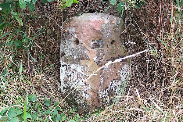 BML98.jpg Sadly defaced, cast iron pieces gone? (taken 11.8.2006) 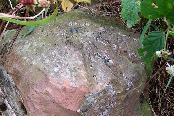 BML99.jpg Bench mark on top. (taken 11.8.2006) |
||
|
|
||
| evidence:- | old map:- OS County Series (Cmd 49 4) placename:- |
|
| source data:- | Maps, County Series maps of Great Britain, scales 6 and 25
inches to 1 mile, published by the Ordnance Survey, Southampton,
Hampshire, from about 1863 to 1948. "M.S. Carlisle .. 14 Penrith .. 4" |
|
|
|
||
| evidence:- | old map:- Donald 1774 (Cmd) |
|
| source data:- | Map, hand coloured engraving, 3x2 sheets, The County of Cumberland, scale about 1
inch to 1 mile, by Thomas Donald, engraved and published by Joseph Hodskinson, 29
Arundel Street, Strand, London, 1774.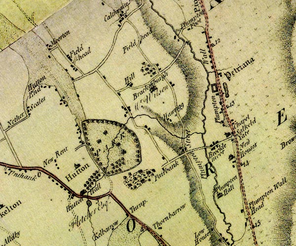 D4NY43NE.jpg "14" milestone; from Carlisle to Penrith item:- Carlisle Library : Map 2 Image © Carlisle Library |
|
|
|
||
 Lakes Guides menu.