 Old Cumbria Gazetteer
 |
 |
|
| Holy Trinity, Mardale | ||
| gone | ||
| Holy Trinity Church | ||
| Mardale Church | ||
| site name:- | Haweswater Reservoir | |
| locality:- | Mardale Green | |
| locality:- | Mardale | |
| civil parish:- | Shap Rural (formerly Westmorland) | |
| county:- | Cumbria | |
| locality type:- | church (flooded) | |
| coordinates:- | NY475117 | |
| 1Km square:- | NY4711 | |
| 10Km square:- | NY41 | |
|
|
||
| evidence:- | old map:- OS County Series (Wmd 20 4) |
|
| source data:- | Maps, County Series maps of Great Britain, scales 6 and 25
inches to 1 mile, published by the Ordnance Survey, Southampton,
Hampshire, from about 1863 to 1948. "Church (Per Curacy)" |
|
|
|
||
| evidence:- | old map:- Jefferys 1770 (Wmd) |
|
| source data:- | Map, 4 sheets, The County of Westmoreland, scale 1 inch to 1
mile, surveyed 1768, and engraved and published by Thomas
Jefferys, London, 1770.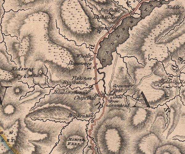 J5NY41SE.jpg church in Mardale item:- National Library of Scotland : EME.s.47 Image © National Library of Scotland |
|
|
|
||
| evidence:- | old map:- Otley 1818 |
|
| source data:- | Map, uncoloured engraving, The District of the Lakes,
Cumberland, Westmorland, and Lancashire, scale about 4 miles to
1 inch, by Jonathan Otley, 1818, engraved by J and G Menzies,
Edinburgh, Scotland, published by Jonathan Otley, Keswick,
Cumberland, et al, 1833.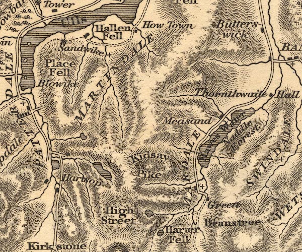 OT02NY41.jpg Marked by a cross. item:- JandMN : 48.1 Image © see bottom of page |
|
|
|
||
| evidence:- | descriptive text:- Otley 1823 (5th edn 1834) item:- memorial; yew |
|
| source data:- | Guide book, A Concise Description of the English Lakes, the
mountains in their vicinity, and the roads by which they may be
visited, with remarks on the mineralogy and geology of the
district, by Jonathan Otley, published by the author, Keswick,
Cumberland now Cumbria, by J Richardson, London, and by Arthur
Foster, Kirkby Lonsdale, Cumbria, 1823; published 1823-49,
latterly as the Descriptive Guide to the English Lakes. goto source goto sourcePage 116:- "Those who wish to penetrate the hidden recesses of the mountains may go the whole length of the lake, and afterwards pass the chapel, which is a small building closely embowered with yews and sycamores, its walls exhibiting some neat monumental inscriptions; particularly one to the memory of one of its ministers, who died in 1799, having served the cure upwards of fifty years. ..." |
|
|
|
||
| evidence:- | descriptive text:- Ford 1839 (3rd edn 1843) placename:- Mardale Chapel |
|
| source data:- | Guide book, A Description of Scenery in the Lake District, by
Rev William Ford, published by Charles Thurnam, Carlisle, by W
Edwards, 12 Ave Maria Lane, Charles Tilt, Fleet Street, William
Smith, 113 Fleet Street, London, by Currie and Bowman,
Newcastle, by Bancks and Co, Manchester, by Oliver and Boyd,
Edinburgh, and by Sinclair, Dumfries, 1839. goto source Page 138:- "..." "About one mile further from the head of the lake [Hawes Water] stands Mardale Chapel, which is under Shap; it is a wild solitary region, surrounded by lofty mountains and fells. Near this, in former days, there stood 'a simple cottage ...' its owners had lived there in succession for many generations. A few paces took them to Mardale Chapel, their place of worship, and when they died, their long home was on their own premises." goto sourcePage 159:- "..." "[Chapelhill] ... Mardale Chapel of Ease, in a picturesque and fertile situation, surrounded by lofty fells, stands here; ..." |
|
|
|
||
| evidence:- | old map:- Garnett 1850s-60s H |
|
| source data:- | Map of the English Lakes, in Cumberland, Westmorland and
Lancashire, scale about 3.5 miles to 1 inch, published by John
Garnett, Windermere, Westmorland, 1850s-60s.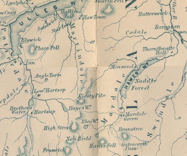 GAR2NY41.jpg cross, a church item:- JandMN : 82.1 Image © see bottom of page |
|
|
|
||
| evidence:- | presumably old text:- Martineau 1855 |
|
| source data:- | Guide book, A Complete Guide to the English Lakes, by Harriet
Martineau, published by John Garnett, Windermere, Westmorland,
and by Whittaker and Co, London, 1855; published 1855-76. goto source Page 173:- "... The path winds through the levels, round the bases of the knolls, past the ruins of the old church, ..." |
|
|
|
||
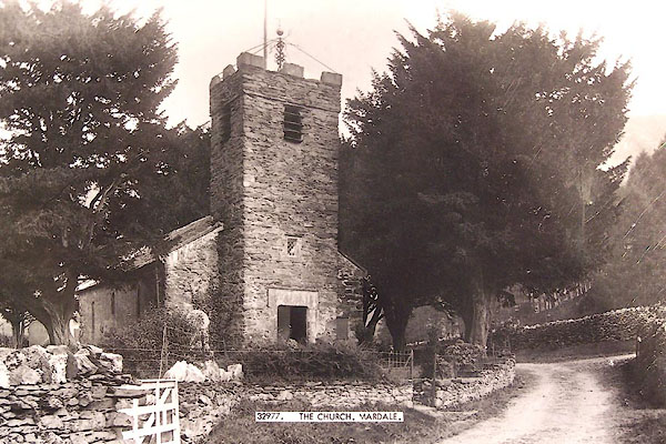
| evidence:- | old print:- Pearson 1900s placename:- Mardale Chapel |
|
| source data:- | Print, halftone photograph, Mardale Chapel, Haweswater, Holy Trinity Church, Mardale,
Shap Rural, Westmorland, published by C Arthur Pearson, Henrietta Street, London,
1900s.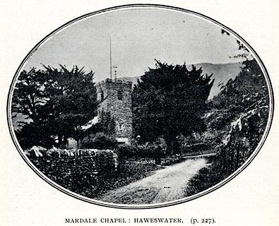 click to enlarge click to enlargePS1E78.jpg On p.228 of Pearson's Gossipy Guide to the English Lakes and Neighbouring Districts. printed at bottom:- "MARDALE CHAPEL: HAWESWATER. (p.227)." item:- Armitt Library : A1188.85 Image © see bottom of page |
|
|
|
||
| evidence:- | old map:- Nurse 1918 |
|
| source data:- | Map, The Diocese of Carlisle, Cumberland, Westmorland, and
Lancashire North of the Sands, scale about 4 miles to 1 inch, by
Rev Euston J Nurse, published by Charles Thurnam and Sons, 11
English Street, Carlisle, Cumberland, 2nd edn 1939.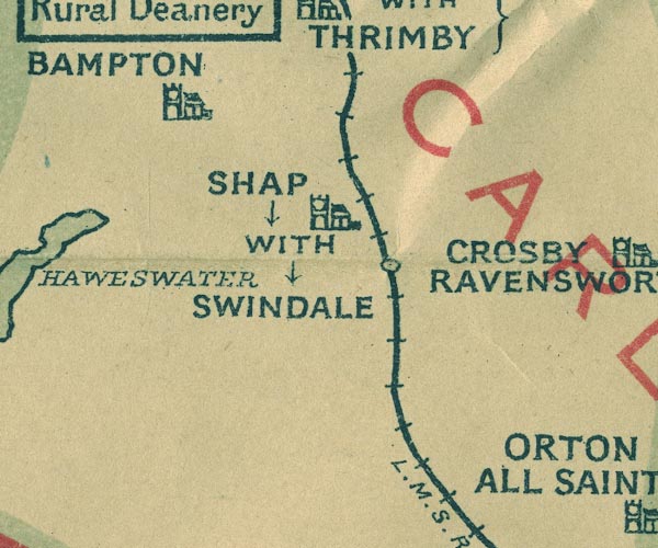 NUR1NY51.jpg "MARDALE" No church symbol. United benefice with Bampton, one parish. item:- JandMN : 27 Image © see bottom of page |
|
|
|
||
| evidence:- | site plan:- Historical Monuments 1936 |
|
| source data:- | Site plan, uncoloured lithograph, Parish Church of Holy Trinity Mardale, Shap Rural,
Westmorland, scale about 1 to 290? published by Royal Commission on Historical Monuments
England, London, 1936.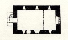 click to enlarge click to enlargeHMW122.jpg On p.207 of the Inventory of the Historical Monuments in Westmorland. RCHME no. Wmd, Shap Rural 1 item:- Armitt Library : A745.123 Image © see bottom of page |
|
|
|
||
 BNO47.jpg Penrith Museum 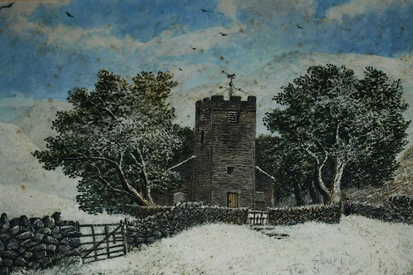 BQF94.jpg Painting in St Patrick's Church, Bampton. |
||
|
|
||
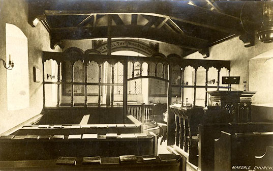 BVN58.jpg "MARDALE CHURCH" and monogram:- "RED" courtesy of John Bennet |
||
|
|
||
Lakes Guides menu.