 Old Cumbria Gazetteer
 |
 |
|
| High Dykes Farm, Clifton | ||
| High Dykes Farm | ||
| locality:- | Clifton Dykes | |
| civil parish:- | Clifton (formerly Westmorland) | |
| county:- | Cumbria | |
| locality type:- | buildings | |
| coordinates:- | NY54232725 | |
| 1Km square:- | NY5427 | |
| 10Km square:- | NY52 | |
|
|
||
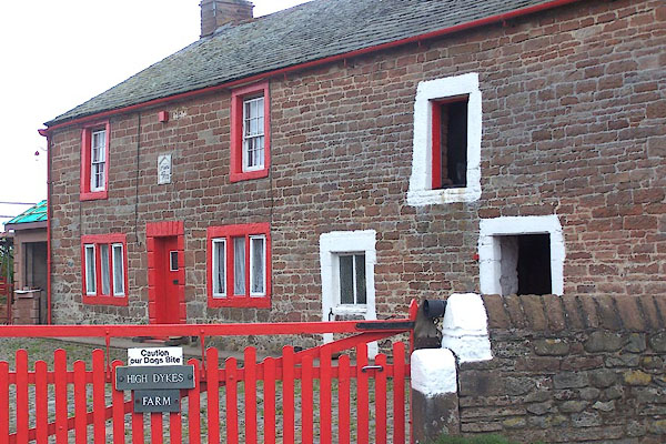 BNT10.jpg (taken 29.5.2007) 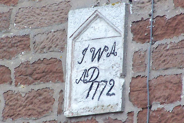 BNT11.jpg Date stone:- "J.W.A. / AD / 1772" (taken 29.5.2007) |
||
|
|
||
| evidence:- | old map:- OS County Series (Wmd 4 13) placename:- High Dikes placename:- Dikes, High |
|
| source data:- | Maps, County Series maps of Great Britain, scales 6 and 25
inches to 1 mile, published by the Ordnance Survey, Southampton,
Hampshire, from about 1863 to 1948. |
|
|
|
||
| evidence:- | database:- Listed Buildings 2010 placename:- High Dykes item:- date stone (1772) |
|
| source data:- | courtesy of English Heritage "HIGH DYKES AND BARN ADJOINING / / / CLIFTON / EDEN / CUMBRIA / II / 74231 / NY5421827253" |
|
|
|
||
 Lakes Guides menu.