 Old Cumbria Gazetteer
 |
 |
|
| Isel Bridge, Isel | ||
| Isel Bridge | ||
| site name:- | Derwent, River | |
| locality:- | Isel | |
| civil parish:- | Blindcrake (formerly Cumberland) | |
| civil parish:- | Setmurthy (formerly Cumberland) | |
| county:- | Cumbria | |
| locality type:- | bridge | |
| coordinates:- | NY16413329 | |
| 1Km square:- | NY1633 | |
| 10Km square:- | NY13 | |
|
|
||
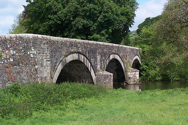 BNR58.jpg (taken 25.5.2007) 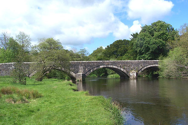 BNR59.jpg (taken 25.5.2007) |
||
|
|
||
| evidence:- | old map:- OS County Series (Cmd 46 14) placename:- Isell Bridge |
|
| source data:- | Maps, County Series maps of Great Britain, scales 6 and 25
inches to 1 mile, published by the Ordnance Survey, Southampton,
Hampshire, from about 1863 to 1948. |
|
|
|
||
| evidence:- | old map:- Saxton 1579 |
|
| source data:- | Map, hand coloured engraving, Westmorlandiae et Cumberlandiae Comitatus ie Westmorland
and Cumberland, scale about 5 miles to 1 inch, by Christopher Saxton, London, engraved
by Augustinus Ryther, 1576, published 1579-1645.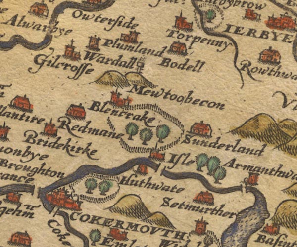 Sax9NY13.jpg At Isle. item:- private collection : 2 Image © see bottom of page |
|
|
|
||
| evidence:- | old map:- Mercator 1595 (edn?) placename:- |
|
| source data:- | Map, hand coloured engraving, Northumbria, Cumberlandia, et
Dunelmensis Episcopatus, ie Northumberland, Cumberland and
Durham etc, scale about 6.5 miles to 1 inch, by Gerard Mercator,
Duisberg, Germany, about 1595.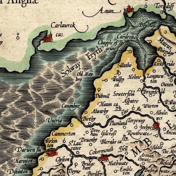 MER8CumB.jpg "" double across a stream; bridge, over the Derwent near Isel item:- JandMN : 169 Image © see bottom of page |
|
|
|
||
| evidence:- | old map:- Speed 1611 (Cmd) |
|
| source data:- | Map, hand coloured engraving, Cumberland and the Ancient Citie
Carlile Described, scale about 4 miles to 1 inch, by John Speed,
1610, published by J Sudbury and George Humble, Popes Head
Alley, London, 1611-12.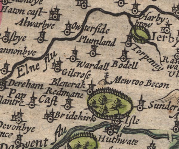 SP11NY13.jpg double line across the Derwent at Isel item:- private collection : 16 Image © see bottom of page |
|
|
|
||
| evidence:- | old map:- Jansson 1646 |
|
| source data:- | Map, hand coloured engraving, Cumbria and Westmoria, ie
Cumberland and Westmorland, scale about 3.5 miles to 1 inch, by
John Jansson, Amsterdam, Netherlands, 1646.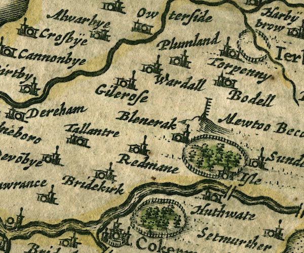 JAN3NY13.jpg Double line crossing the stream. item:- JandMN : 88 Image © see bottom of page |
|
|
|
||
| evidence:- | old map:- Sanson 1679 |
|
| source data:- | Map, hand coloured engraving, Ancien Royaume de Northumberland
aujourdhuy Provinces de Nort, ie the Ancient Kingdom of
Northumberland or the Northern Provinces, scale about 9.5 miles
to 1 inch, by Nicholas Sanson, Paris, France, 1679. click to enlarge click to enlargeSAN2Cm.jpg double line over a stream; bridge item:- Dove Cottage : 2007.38.15 Image © see bottom of page |
|
|
|
||
| evidence:- | old map:- Seller 1694 (Cmd) |
|
| source data:- | Map, uncoloured engraving, Cumberland, scale about 12 miles to 1
inch, by John Seller, 1694. click to enlarge click to enlargeSEL9.jpg two lines cross a stream; bridge item:- Dove Cottage : 2007.38.89 Image © see bottom of page |
|
|
|
||
| evidence:- | old map:- Morden 1695 (Cmd) |
|
| source data:- | Map, uncoloured engraving, Cumberland, scale about 4 miles to 1
inch, by Robert Morden, 1695, published by Abel Swale, the
Unicorn, St Paul's Churchyard, Awnsham, and John Churchill, the
Black Swan, Paternoster Row, London, 1695-1715.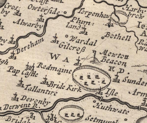 MD12NY13.jpg Double line over the Derwent, near Isel. item:- JandMN : 90 Image © see bottom of page |
|
|
|
||
| evidence:- | old drawing:- Green 1790s-1820s |
|
| source data:- | Drawing, pencil, View on the Derwent river near Isel, Blindcrake and Setmurthy, Cumberland,
by William Green, Ambleside, Westmorland, 1800.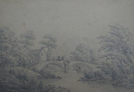 click to enlarge click to enlargePR1727.jpg ms at bottom left:- "View of the Derwent river near Isel." courtesy of Abbot Hall Art Gallery, Kendal item:- Abbot Hall : AH741.69 Image © see bottom of page |
|
|
|
||
| evidence:- | database:- Listed Buildings 2010 placename:- Isel Bridge |
|
| source data:- | courtesy of English Heritage "ISEL BRIDGE / / / BLINDCRAKE / ALLERDALE / CUMBRIA / II / 72556 / NY1641633297" |
|
| source data:- | courtesy of English Heritage "Road bridge. 1812 replacing one of 1691 on the same site. Mixed calciferous and pink sandstone. 3 segmental arches on 2 piers with splayed cutwaters. Solid parapet with saddle-back coping. This bridge lies partly in Setmurthy parish." |
|
|
|
||
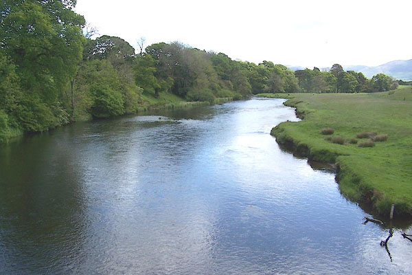 BNR60.jpg View of river. (taken 25.5.2007) |
||
|
|
||
 Lakes Guides menu.