 Old Cumbria Gazetteer
 |
 |
|
|||||||||
goto  tenKm squares tenKm squares |
|||||||||||
| SD89 | |||||||||||
| civil parish:- | Mallerstang (formerly Westmorland) | ||||||||||
| county:- | Cumbria | ||||||||||
| locality type:- | 10Km square | ||||||||||
| 10Km square:- | SD89 | ||||||||||
|
|
|||||||||||
| adjacent:- |
|
||||||||||
| 1Km squares:- | 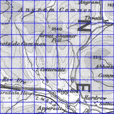 click on an active square click on an active square |
||||||||||
|
|
|||||||||||
| evidence:- | old map:- OS 1946 Quarter Inch |
||||||||||
| source data:- | Maps, sheet 1, The Border, and sheet 2, England, North Central,
in the Quarter Inch Map of Great Britain series, 4th edn with
National Grid in yards, scale 4 miles to 1 inch, published by
the Ordnance Survey, Southampton, Hampshire, 1946.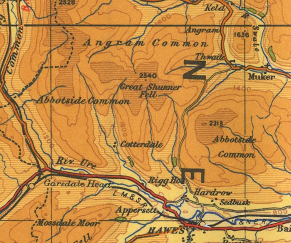 OS24SD89.jpg item:- JandMN : 103 Image © see bottom of page |
||||||||||
|
|
|||||||||||
| evidence:- | old map:- Jansson 1646 |
||||||||||
| source data:- | Map, hand coloured engraving, Cumbria and Westmoria, ie
Cumberland and Westmorland, scale about 3.5 miles to 1 inch, by
John Jansson, Amsterdam, Netherlands, 1646.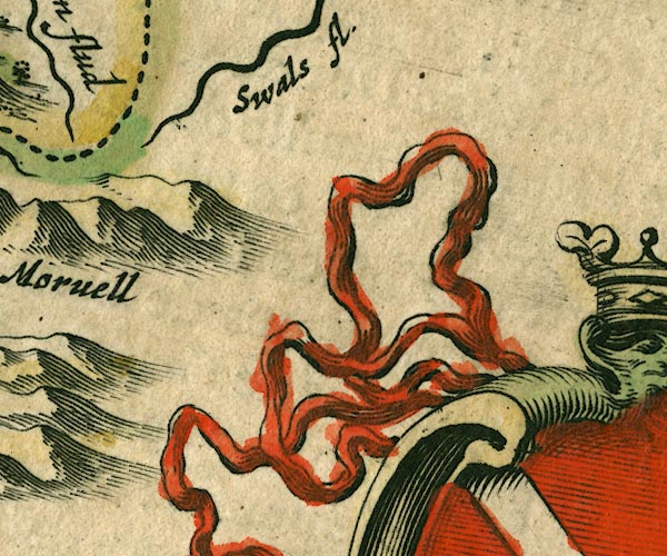 JAN3SD89.jpg Approximate 10Km square, plus overlaps. item:- JandMN : 88 Image © see bottom of page |
||||||||||
|
|
|||||||||||
| evidence:- | old map:- Jefferys 1770 (Wmd) |
||||||||||
| source data:- | Map, 4 sheets, The County of Westmoreland, scale 1 inch to 1
mile, surveyed 1768, and engraved and published by Thomas
Jefferys, London, 1770.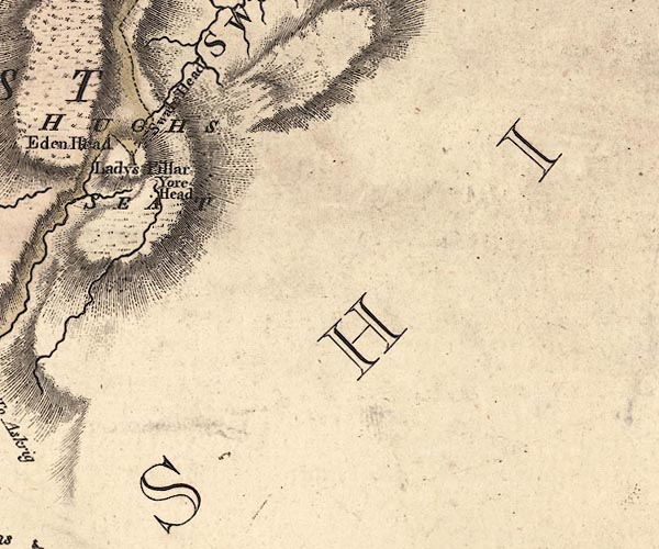 J5SD89NW.jpg Approximate 5Km squares, plus overlaps item:- National Library of Scotland : EME.s.47 Image © National Library of Scotland |
||||||||||
|
|
|||||||||||
 Lakes Guides menu.