 Old Cumbria Gazetteer
 |
 |
|
| Victoria Hall, Grange-over-Sands | ||
| Victoria Hall | ||
| Street:- | Main Street | |
| locality:- | Grange-over-Sands | |
| civil parish:- | Grange-over-Sands (formerly Lancashire) | |
| county:- | Cumbria | |
| locality type:- | village hall (?) | |
| locality type:- | police station (?) | |
| locality type:- | tourist information centre | |
| coordinates:- | SD40847797 | |
| 1Km square:- | SD4077 | |
| 10Km square:- | SD47 | |
|
|
||
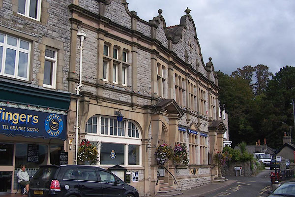 BOE79.jpg (taken 28.9.2007) 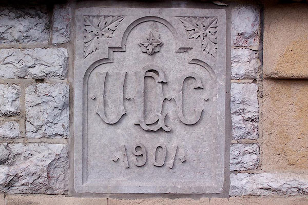 BOE80.jpg Plaque:- "G / UDC / 1901" (taken 28.9.2007) |
||
| Opened 1901 to commemorate the Diamond Jubilee of Victoria. It is built on the site
of Laurel House, owned by James Joseph. |
||
|
|
||
| evidence:- | old map:- OS County Series (Lan 17 4) placename:- Victoria Hall |
|
| source data:- | Maps, County Series maps of Great Britain, scales 6 and 25
inches to 1 mile, published by the Ordnance Survey, Southampton,
Hampshire, from about 1863 to 1948. |
|
|
|
||
| evidence:- | database:- Listed Buildings 2010 |
|
| source data:- | courtesy of English Heritage "COUNCIL OFFICES / / MAIN STREET / GRANGE OVER SANDS / SOUTH LAKELAND / CUMBRIA / II / 460539 / SD4084377988" |
|
|
|
||
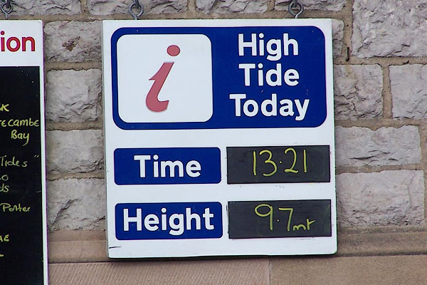 BOE81.jpg Tide time and height, from the Tourist Information Centre. (taken 28.9.2007) |
||
|
|
||
 Lakes Guides menu.