 Old Cumbria Gazetteer
 |
 |
|
| Barrow Head, Barrow-in-Furness | ||
| Barrow Head | ||
| locality:- | Barrow-in-Furness | |
| civil parish:- | Barrow-in-Furness (formerly Lancashire) | |
| county:- | Cumbria | |
| locality type:- | locality | |
| coordinates:- | SD198689 (etc) | |
| 1Km square:- | SD1968 | |
| 10Km square:- | SD16 | |
| references:- | Greenwood 1824 |
|
|
|
||
| evidence:- | old map:- Mercator 1595 (edn?) placename:- Barrohead |
|
| source data:- | Map, hand coloured engraving, Westmorlandia, Lancastria, Cestria
etc, ie Westmorland, Lancashire, Cheshire etc, scale about 10.5
miles to 1 inch, by Gerard Mercator, Duisberg, Germany, 1595,
edition 1613-16.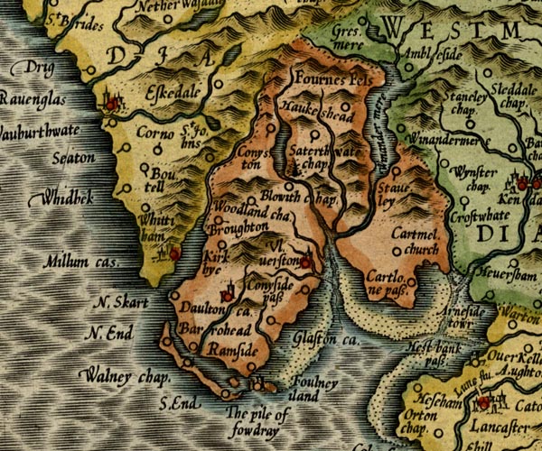 MER5LanA.jpg "Barrohead" circle item:- Armitt Library : 2008.14.3 Image © see bottom of page |
|
|
|
||
| evidence:- | old map:- Greenwood 1824 placename:- Barrow Head |
|
| source data:- | Maps, Map of the County of Westmorland, scale about 1 inch to 1
mile, and Map of the County of Cumberland, scale about 1 inch to
1 mile, etc, by C and J Greenwood, published by George Pringle
jnr, 70 Queen Street, Cheapside, London, 1823 and 1824
respectively. "Barrow Head" |
|
|
|
||
| evidence:- | old map:- Ford 1839 map placename:- Barrow Head |
|
| source data:- | Map, uncoloured engraving, Map of the Lake District of
Cumberland, Westmoreland and Lancashire, scale about 3.5 miles
to 1 inch, published by Charles Thurnam, Carlisle, and by R
Groombridge, 5 Paternoster Row, London, 3rd edn 1843.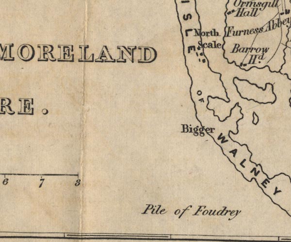 FD02SD16.jpg "Barrow Hd." item:- JandMN : 100.1 Image © see bottom of page |
|
|
|
||
 Lakes Guides menu.