 Old Cumbria Gazetteer
 |
 |
|
| Creep-i'-th'-call Bridge, Beetham | ||
| Creep-i'-th'-call Bridge | ||
| site name:- | Leighton Beck | |
| civil parish:- | Beetham (formerly Westmorland) | |
| county:- | Cumbria | |
| locality type:- | bridge | |
| locality type:- | boundary feature | |
| locality type:- | county boundary feature | |
| coordinates:- | SD47707816 | |
| 1Km square:- | SD4778 | |
| 10Km square:- | SD47 | |
| county:- | Lancashire | |
| current boundary | ||
| locality:- | Cumbria boundary | |
|
|
||
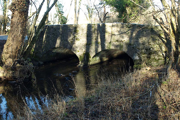 BQB17.jpg (taken 6.2.2009) 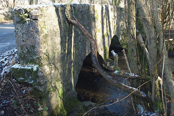 BQB18.jpg (taken 6.2.2009) |
||
|
|
||
| evidence:- | old map:- OS County Series (Wmd 46 10) placename:- Creepock Hole Bridge |
|
| source data:- | Maps, County Series maps of Great Britain, scales 6 and 25
inches to 1 mile, published by the Ordnance Survey, Southampton,
Hampshire, from about 1863 to 1948. |
|
|
|
||
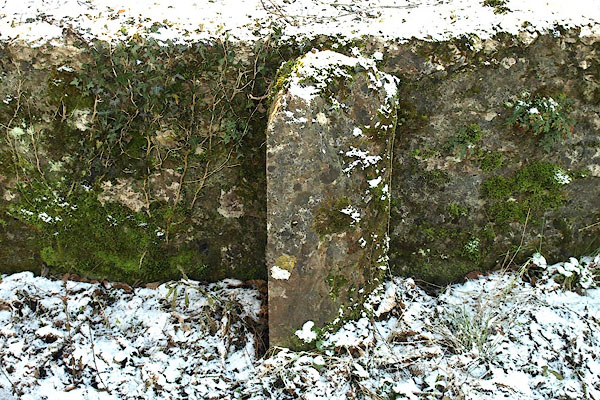 BQB19.jpg Defaced boundary stone on the bridge? (taken 6.2.2009) |
||
|
|
||
 Lakes Guides menu.