 Old Cumbria Gazetteer
 |
 |
|
| King Harry, Cumwhitton | ||
| King Harry | ||
| civil parish:- | Cumwhitton (formerly Cumberland) | |
| county:- | Cumbria | |
| locality type:- | locality | |
| coordinates:- | NY541485 (etc) | |
| 1Km square:- | NY5448 | |
| 10Km square:- | NY54 | |
|
|
||
| evidence:- | old map:- Donald 1774 (Cmd) placename:- King Harry |
|
| source data:- | Map, hand coloured engraving, 3x2 sheets, The County of Cumberland, scale about 1
inch to 1 mile, by Thomas Donald, engraved and published by Joseph Hodskinson, 29
Arundel Street, Strand, London, 1774.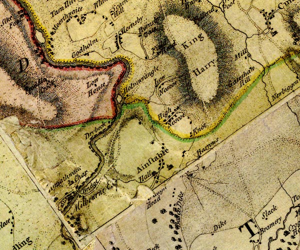 D4NY54NW.jpg "King Harry" hill hachuring; a hill or mountain item:- Carlisle Library : Map 2 Image © Carlisle Library |
|
|
|
||
| hearsay:- |
This 'bleak, hilly, trackless waste' was where King Henry camped during a campaign
in the north country. This was probably Henry VI after the Battle of Hexham, 1464,
during the Wars of the Roses, in the gap in his reign when Edward IV was on the throne. |
|
|
|
||
 Lakes Guides menu.