 Old Cumbria Gazetteer
 |
 |
|
| milestone, Preston Patrick (3) | ||
| site name:- | road, Kendal to Kirkby Lonsdale | |
| civil parish:- | Preston Patrick (formerly Westmorland) | |
| county:- | Cumbria | |
| locality type:- | milestone | |
| coordinates:- | SD57758537 | |
| 1Km square:- | SD5785 | |
| 10Km square:- | SD58 | |
|
|
||
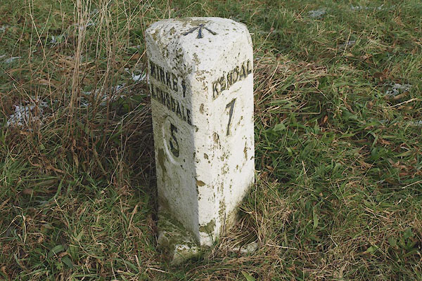 BPW43.jpg Inscribed stone:- "KIRKBY LONSDALE 5 / KENDAL 7" (taken 2.1.2009) 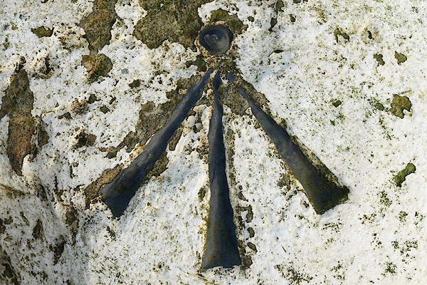 BPW44.jpg Rivet bench mark on top. (taken 2.1.2009) |
||
|
|
||
| evidence:- | old map:- OS County Series (Wmd 43 7) placename:- |
|
| source data:- | Maps, County Series maps of Great Britain, scales 6 and 25
inches to 1 mile, published by the Ordnance Survey, Southampton,
Hampshire, from about 1863 to 1948. "MS Kendal .. 7 Kirkby Lonsdale .. 5" |
|
|
|
||
| evidence:- | database:- Listed Buildings 2010 |
|
| source data:- | courtesy of English Heritage "MILESTONE APPROXIMATELY 180 METRES NORTH WEST OF ENTRANCE TO BARKIN HOUSE / / B6254 / PRESTON PATRICK / SOUTH LAKELAND / CUMBRIA / II / 76626 / SD5774785377" |
|
| source data:- | courtesy of English Heritage "Milestone. Probably early C19. Dressed limestone. Upright stone with round head and deep chamfers (no stops visible at time of survey) to front corners. Painted black and white with numbers in oval panels:" "5 / KIRKBY- / LONSDALE" "on North-West" "7 / KENDAL" "on South-East side." "A variant of a type listed in neighbouring Parishes." |
|
|
|
||
 Lakes Guides menu.