 Old Cumbria Gazetteer
 |
 |
|
| Nichol Forest, Nicholforest | ||
| Nichol Forest | ||
| civil parish:- | Nicholforest (formerly Cumberland) | |
| county:- | Cumbria | |
| locality type:- | area | |
| coordinates:- | NY45767748 (etc) | |
| 1Km square:- | NY4577 | |
| 10Km square:- | NY47 | |
| 10Km square:- | NY48 | |
|
|
||
| evidence:- | old map:- Donald 1774 (Cmd) placename:- Nichol Forest |
|
| source data:- | Map, hand coloured engraving, 3x2 sheets, The County of Cumberland, scale about 1
inch to 1 mile, by Thomas Donald, engraved and published by Joseph Hodskinson, 29
Arundel Street, Strand, London, 1774.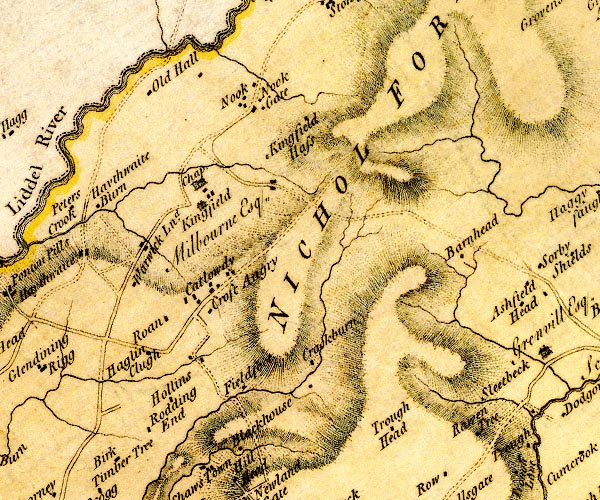 D4NY47NE.jpg 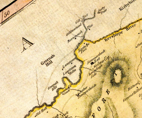 D4NY48SE.jpg "NICHOL FOREST" area item:- Carlisle Library : Map 2 Images © Carlisle Library |
|
|
|
||
| evidence:- | old map:- Cooper 1808 placename:- Nichol Forest |
|
| source data:- | Map, uncoloured engraving, Cumberland, scale about 10.5 miles to
1 inch, drawn and engraved by Cooper, published by R Phillips,
Bridge Street, Blackfriars, London, 1808. click to enlarge click to enlargeCOP3.jpg "Nichol Forest" area item:- JandMN : 86 Image © see bottom of page |
|
|
|
||
| evidence:- | old map:- Ford 1839 map placename:- Nichol Forest |
|
| source data:- | Map, uncoloured engraving, Map of the Lake District of
Cumberland, Westmoreland and Lancashire, scale about 3.5 miles
to 1 inch, published by Charles Thurnam, Carlisle, and by R
Groombridge, 5 Paternoster Row, London, 3rd edn 1843.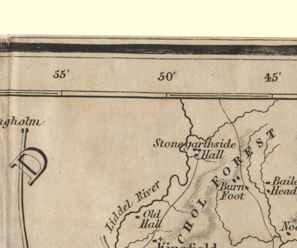 FD02NY48.jpg "NICHOL FOREST" Area. item:- JandMN : 100.1 Image © see bottom of page |
|
|
|
||
 Lakes Guides menu.