 Old Cumbria Gazetteer
 |
 |
|
| Powe House, Portinscale | ||
| Powe House | ||
| locality:- | Portinscale | |
| civil parish:- | Above Derwent (formerly Cumberland) | |
| county:- | Cumbria | |
| locality type:- | buildings | |
| coordinates:- | NY24812371 | |
| 1Km square:- | NY2423 | |
| 10Km square:- | NY22 | |
|
|
||
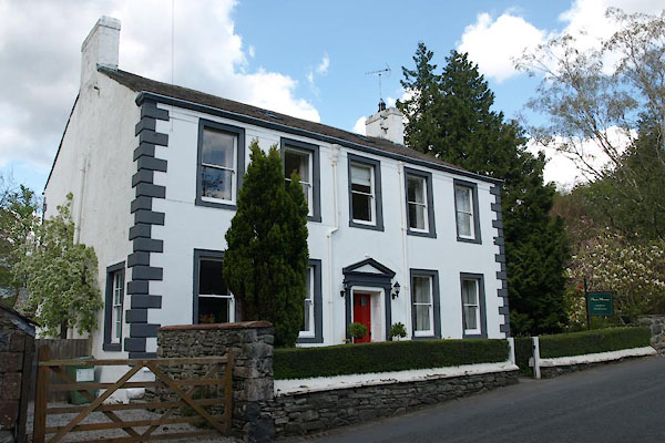 BYI38.jpg (taken 17.5.2013) |
||
|
|
||
| evidence:- | old map:- OS County Series (Cmd 64 5) placename:- Pow House |
|
| source data:- | Maps, County Series maps of Great Britain, scales 6 and 25
inches to 1 mile, published by the Ordnance Survey, Southampton,
Hampshire, from about 1863 to 1948. |
|
|
|
||
| evidence:- | old map:- Ford 1839 map placename:- Pow House |
|
| source data:- | Map, uncoloured engraving, Map of the Lake District of
Cumberland, Westmoreland and Lancashire, scale about 3.5 miles
to 1 inch, published by Charles Thurnam, Carlisle, and by R
Groombridge, 5 Paternoster Row, London, 3rd edn 1843.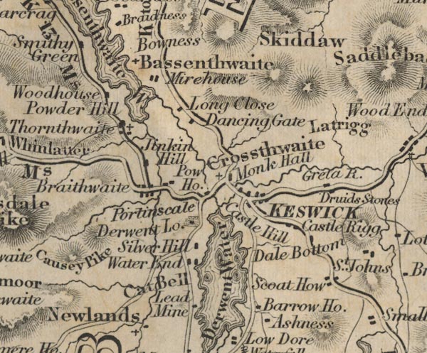 FD02NY22.jpg "Pow Ho." item:- JandMN : 100.1 Image © see bottom of page |
|
|
|
||
| evidence:- | database:- Listed Buildings 2010 placename:- Pow House |
|
| source data:- | courtesy of English Heritage "POW HOUSE / / / ABOVE DERWENT / ALLERDALE / CUMBRIA / II / 72089 / NY2481323719" |
|
|
|
||
 Lakes Guides menu.