 Old Cumbria Gazetteer
 |
 |
|
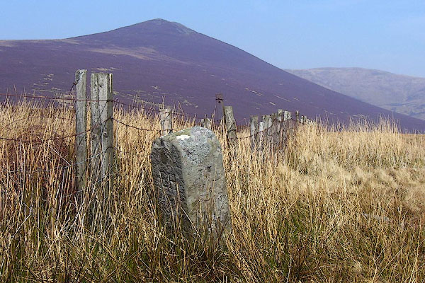
| Stake, Underskiddaw | ||
| civil parish:- | Underskiddaw (formerly Cumberland) | |
| civil parish:- | Threlkeld (formerly Cumberland) | |
| civil parish:- | Mungrisdale (formerly Cumberland) | |
| county:- | Cumbria | |
| locality type:- | boundary stone | |
| locality type:- | parish boundary mark | |
| locality type:- | estate boundary mark | |
| coordinates:- | NY29612880 | |
| 1Km square:- | NY2928 | |
| 10Km square:- | NY22 | |
| SummaryText:- | The boundary marked appears to be between four different land owners, and happens to be at a parish boundary. | |
|
|
||
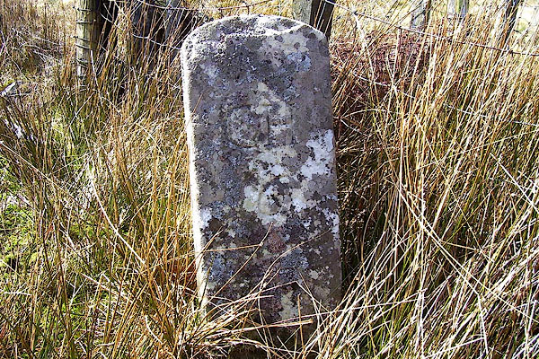
 BPC18.jpg (taken 22.4.2008) 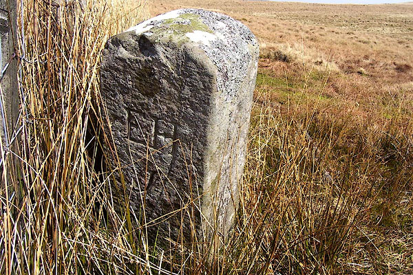 BPC19.jpg Inscribed stone:- "EH / [J]" (taken 22.4.2008) |
||
|
|
||
| evidence:- | old map:- OS County Series (Cmd 56 7) placename:- Stake, The |
|
| source data:- | Maps, County Series maps of Great Britain, scales 6 and 25
inches to 1 mile, published by the Ordnance Survey, Southampton,
Hampshire, from about 1863 to 1948. "The Stake / Boundary Post" |
|
|
|
||
 BPC20.jpg Inscribed stone:- "CH / 6" (taken 22.4.2008) 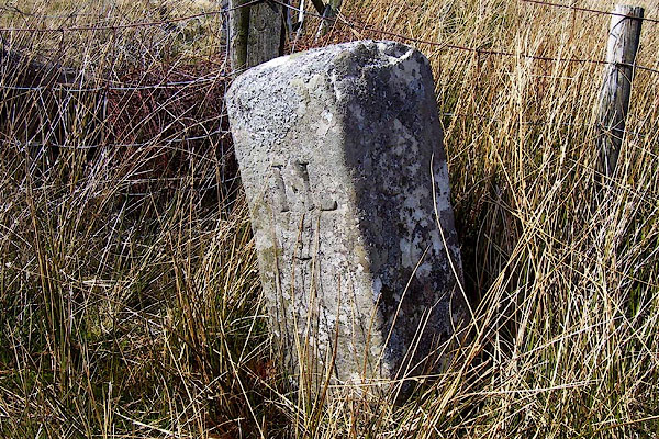 BPC21.jpg Inscribed stone:- "IL / 7" (taken 22.4.2008) 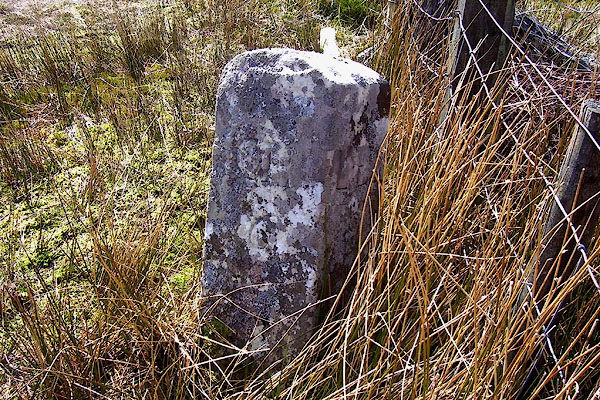 BPC22.jpg Inscribed stone:- "CH / 6" "LE / 9" (taken 22.4.2008) |
||
|
|
||
| hearsay:- |
The landowners suggested are:- |
|
| EH Edward Hassell |
||
| IL James Lowther |
||
| CH Charles Howard |
||
| LE Lord Egremont |
||
| and the numbers perhaps the distance to their seats. |
||
|
|
||
 Lakes Guides menu.