 Old Cumbria Gazetteer
 |
 |
|
| White Hart, Kendal | ||
| White Hart | ||
| Street:- | Yard 2 | |
| Street:- | Highgate | |
| locality:- | Kendal | |
| civil parish:- | Kendal (formerly Westmorland) | |
| county:- | Cumbria | |
| locality type:- | inn | |
| coordinates:- | SD51459270 | |
| 1Km square:- | SD5192 | |
| 10Km square:- | SD59 | |
| references:- | Wallis 1810 |
|
|
|
||
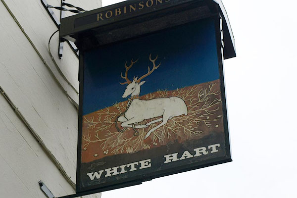 BRZ06.jpg Innsign - a white hart. (taken 19.1.2010) 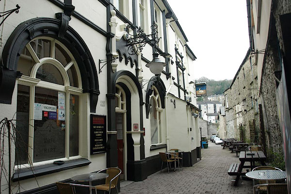 BRZ04.jpg (taken 19.1.2010) |
||
|
|
||
| evidence:- | road book:- Cary 1798 (2nd edn 1802) placename:- White Hart |
|
| source data:- | Road book, itineraries, Cary's New Itinerary, by John Cary, 181
Strand, London, 2nd edn 1802. goto source goto source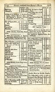 click to enlarge click to enlargeC38315.jpg page 315-316 "INNS. Kendal, Crown, King's Arms, W. Hart." goto source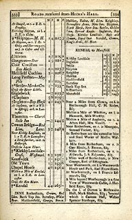 click to enlarge click to enlargeC38333.jpg page 333-334 "INNS. ... Kendal, Crown, King's Arms, W. Hart." item:- JandMN : 228.1 Image © see bottom of page |
|
|
|
||
| evidence:- | descriptive text:- Wallis 1810 placename:- White Hart |
|
| source data:- | Map, Westmoreland, scale about 19 miles to 1 inch, and
Cumberland, scale about 16 miles to 1 inch, by James Wallis, 77
Berwick Street, Soho, London, 1810; published 1810-36. "PRINCIPAL INNS, RECOMMENDED TO TRAVELLERS AND FAMILIES." "Kendal: Crown, King's Arms, White Hart, besides several others, where travellers will be well accommodated, at low charges." |
|
|
|
||
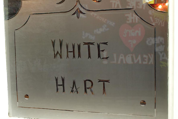 BRZ05.jpg Window, engraved glass:- "WHITE HART" (taken 19.1.2010) |
||
|
|
||
| Currington, David: 2009: Pictorial Record of Public Houses in Kendal: Westmorland
CAMRA |
||
|
|
||
Lakes Guides menu.