 Old Cumbria Gazetteer
 |
 |
|
| included in:- |
 St John, Ulpha St John, Ulpha |
|
| sundial, Ulpha | ||
| site name:- | St John's Church | |
| locality:- | Ulpha | |
| civil parish:- | Ulpha (formerly Cumberland) | |
| county:- | Cumbria | |
| locality type:- | sundial | |
| coordinates:- | SD19799325 | |
| 1Km square:- | SD1993 | |
| 10Km square:- | SD19 | |
|
|
||
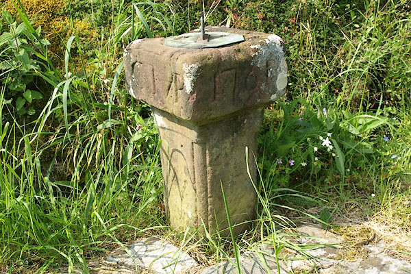 BQQ24.jpg The pedestal is inscribed "CMP / 1761" (taken 29.5.2009) 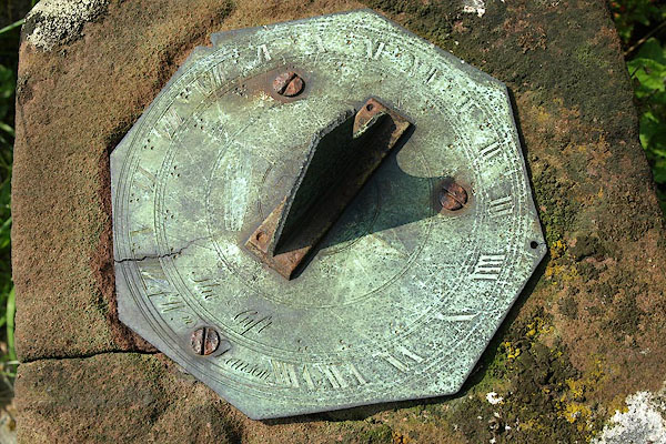 BQQ25.jpg (taken 29.5.2009) |
||
|
|
||
| evidence:- | old map:- OS County Series (Cmd 83 15) |
|
| source data:- | Maps, County Series maps of Great Britain, scales 6 and 25
inches to 1 mile, published by the Ordnance Survey, Southampton,
Hampshire, from about 1863 to 1948. "Sundial" north of church |
|
|
|
||
| evidence:- | database:- Listed Buildings 2010 |
|
| source data:- | courtesy of English Heritage "SUNDIAL IN CHURCHYARD TO NORTH OF CHURCH / / / ULPHA / COPELAND / CUMBRIA / II / 76286 / SD1979693259" |
|
| source data:- | courtesy of English Heritage "Sundial; dated 1761, with initials C.M.P., on sides of block. Sandstone shaft, with moulded edges, surmounted by block, square in plan, c1 1/2 ft high. Octagonal brass sundial plate, with gnomon, is later addition inscribed The gift of Wm Danson." |
|
|
|
||
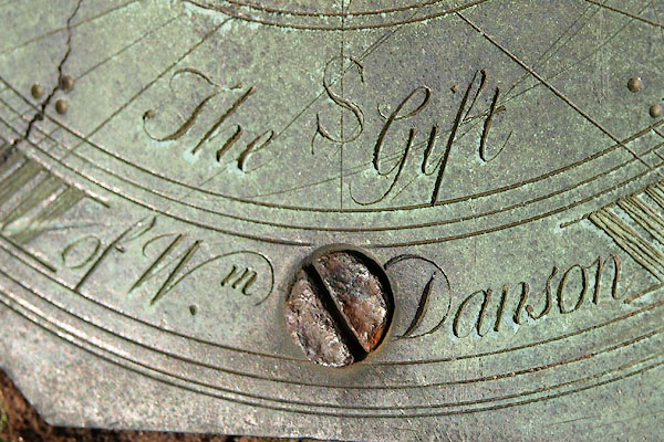 BQQ26.jpg Inscribed:- "The Gift / of Wm. Danson" (taken 29.5.2009) |
||
|
|
||
| notes:- |
Cumbrian Sundials database, R Sylvester, 29.5.2008:- |
|
| "Ulpha, Dunnerdale / St. John's church, left of lychgate / Half plinth by rocky outcrop" |
||
| made 1750 |
||
| British Sundial Society reference number 186 |
||
|
|
||
Lakes Guides menu.