 Old Cumbria Gazetteer
 |
 |
|
| milestone, Preston Richard (3) | ||
| site name:- | road, Lancaster to Kendal E | |
| civil parish:- | Preston Richard (formerly Westmorland) | |
| county:- | Cumbria | |
| locality type:- | milestone | |
| coordinates:- | SD53538419 (?) | |
| 1Km square:- | SD5384 | |
| 10Km square:- | SD58 | |
| references:- | OS County Series |
|
|
|
||
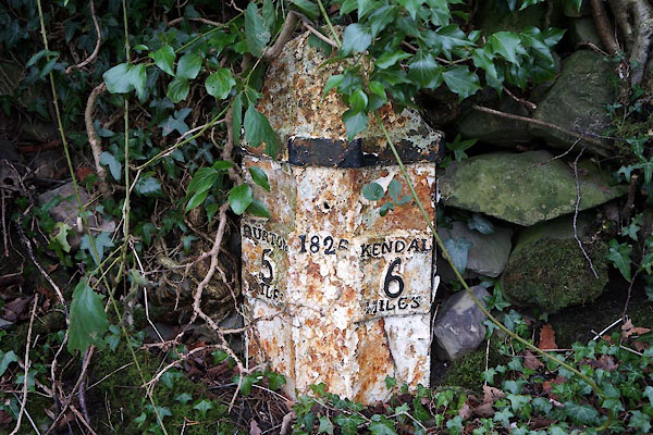 CEL96.jpg Cast iron, from foundry at Gatebeck:- "BURTON / 5 / MILES" "182[ ]" "KENDAL / 6 / MILES" (taken 1.1.2016) |
||
|
|
||
| evidence:- | old map:- OS County Series (Wmd 43 9) |
|
| source data:- | Maps, County Series maps of Great Britain, scales 6 and 25
inches to 1 mile, published by the Ordnance Survey, Southampton,
Hampshire, from about 1863 to 1948. "M.S. Burton .. 5 Kendal .. 6" |
|
|
|
||
| evidence:- | old map:- Jefferys 1770 (Wmd) |
|
| source data:- | Map, 4 sheets, The County of Westmoreland, scale 1 inch to 1
mile, surveyed 1768, and engraved and published by Thomas
Jefferys, London, 1770.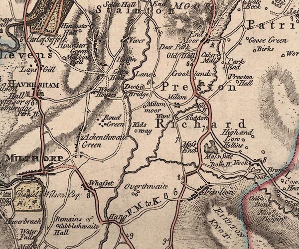 J5SD58SW.jpg "6" milestone marked by road item:- National Library of Scotland : EME.s.47 Image © National Library of Scotland |
|
|
|
||
| evidence:- | database:- Listed Buildings 2010 |
|
| source data:- | courtesy of English Heritage "MILESTONE 100 YARDS SOUTH OF SOUTH LODGE / / A65 / PRESTON RICHARD / SOUTH LAKELAND / CUMBRIA / II / 76523 / SD5353484196" |
|
| source data:- | courtesy of English Heritage "Milestone. Dated 1826. Cast-Iron. Half hexagonal with fluted face and domed top. Painted black and white. Marked:" "BURTON / 5 / MILES" "on North side" "KENDAL / 6 MILES" "on South side." "One of a series of similar Milestones and Boundary Stones on the old Turnpike road." |
|
|
|
||
 Lakes Guides menu.