 Old Cumbria Gazetteer
 |
 |
|
| milestone, Rockcliffe (4) | ||
| site name:- | road, Carlisle to Longtown | |
| civil parish:- | Rockcliffe (formerly Cumberland) | |
| county:- | Cumbria | |
| locality type:- | milestone | |
| coordinates:- | NY39606104 | |
| 1Km square:- | NY3961 | |
| 10Km square:- | NY36 | |
|
|
||
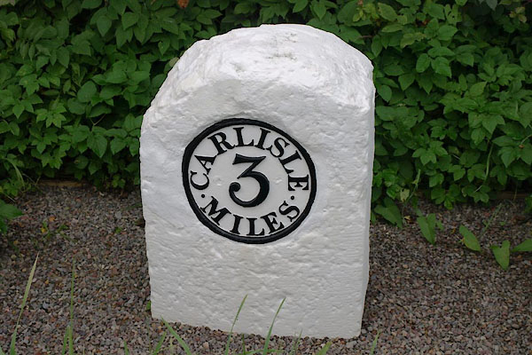 BZJ35.jpg "CARLISLE / 3 / MILES" (taken 27.9.2013) |
||
|
|
||
| evidence:- | old map:- OS County Series (Cmd 16 7) placename:- |
|
| source data:- | Maps, County Series maps of Great Britain, scales 6 and 25
inches to 1 mile, published by the Ordnance Survey, Southampton,
Hampshire, from about 1863 to 1948. "M.S. Carlisle .. 3" |
|
|
|
||
| evidence:- | database:- Listed Buildings 2010 |
|
| source data:- | courtesy of English Heritage "MILESTONE AT NATIONAL GRID REFERENCE NY 39610 61400 / / / ROCKCLIFFE / CARLISLE / CUMBRIA / II / 77939 / NY3960761044" |
|
| source data:- | courtesy of English Heritage "Milestone. Probably 1793 for Carlisle-Longtown Turnpike. Whitewashed sandstone, cast-iron plate. Rounded-top stone has recessed circular cast plate on front, with raised lettering picked-out in black, CARLISLE 3 MILES." |
|
|
|
||
 Lakes Guides menu.