Old Cumbria Gazetteer
 |
 |
|
||
| road, Kendal to Ulverston | ||||
| Kendal to Ulverston | ||||
| Ulverston to Kendal | ||||
| locality:- | Kendal | |||
| civil parish:- | Kendal (formerly Westmorland) | |||
| county:- | Cumbria | |||
| locality type:- | route | |||
| locality:- | Ulverston | |||
| civil parish:- | Ulverston (formerly Lancashire) | |||
| county:- | Cumbria | |||
| locality type:- | route | |||
|
|
||||
| route parts:- |  Kendal to Newby Bridge Newby Bridge to Ulverston Kendal to Newby Bridge Newby Bridge to Ulverston |
|||
|
|
||||
| evidence:- | old map:- Bowen and Kitchin 1760 |
|||
| source data:- | Map, hand coloured engraving, A New Map of the Counties of
Cumberland and Westmoreland Divided into their Respective Wards,
scale about 4 miles to 1 inch, by Emanuel Bowen and Thomas
Kitchin et al, published by T Bowles, Robert Sayer, and John
Bowles, London, 1760.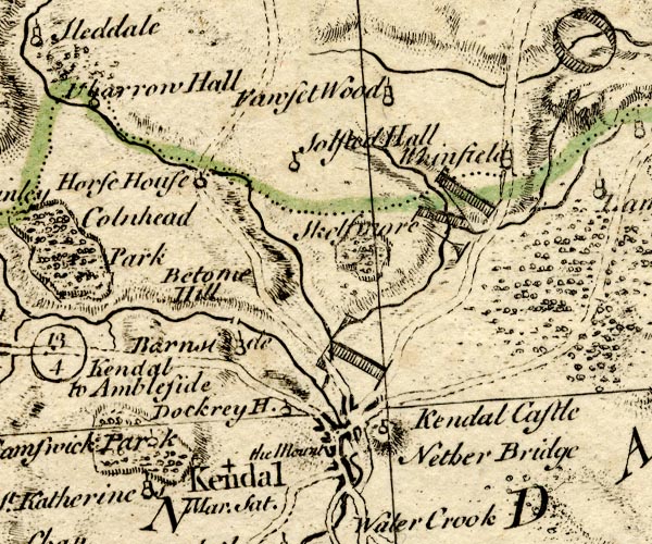 BO18SD49.jpg double line, dotted 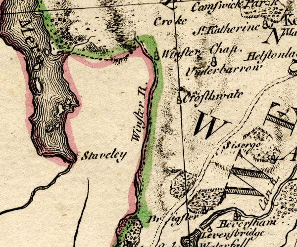 BO18SD38.jpg double line, dotted 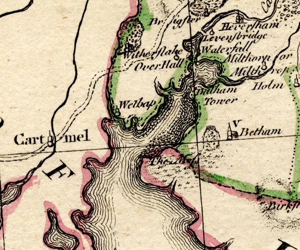 BO18SD37.jpg double line, dotted 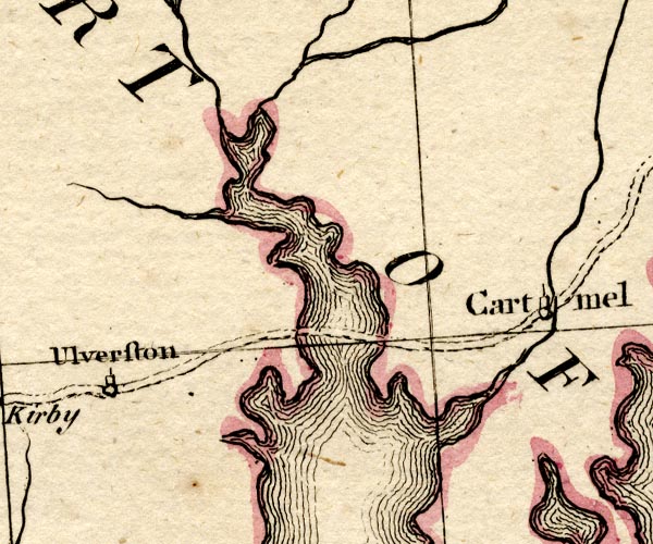 BO18SD27.jpg double line, dotted item:- Armitt Library : 2008.14.10 Image © see bottom of page |
|||
|
|
||||
| evidence:- | old map:- Jefferys 1770 |
|||
| source data:- | Map, 4 sheets, The County of Westmoreland, scale 1 inch to 1
mile, surveyed 1768, and engraved and published by Thomas
Jefferys, London, 1770. J55192H.jpg road item:- National Library of Scotland : EME.s.47 Image © National Library of Scotland |
|||
|
|
||||
| evidence:- | old map:- Cary 1789 (edn 1805) |
|||
| source data:- | Map, uncoloured engraving, Westmoreland, scale about 2.5 miles
to 1 inch, by John Cary, London, 1789; edition 1805. CY24SD59.jpg double line, bold light, numbered miles; main road item:- JandMN : 129 Image © see bottom of page |
|||
|
|
||||
| evidence:- | road map:- Cary 1790 (Wmd/edn 1792) |
|||
| source data:- | Road map, hand coloured engraving, Westmoreland, scale about
11.5 miles to 1 inch, by John Cary, 181 Strand, London, 1790,
edn 1792.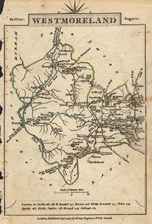 click to enlarge click to enlargeCY16.jpg "to Ulverton and Dalton" double line, with road distances from Kendal item:- JandMN : 44 Image © see bottom of page |
|||
|
|
||||
| evidence:- | road book:- Cary 1798 (2nd edn 1802) |
|||
| source data:- | Road book, itineraries, Cary's New Itinerary, by John Cary, 181
Strand, London, 2nd edn 1802. goto source goto source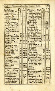 click to enlarge click to enlargeC38267.jpg page 267-268 "At Kendal ... on l. [T.Rs.] to Milthorpe, Ulverston, Winander Mere, and Ambleside." item:- JandMN : 228.1 Image © see bottom of page |
|||
|
|
||||
| evidence:- | road book:- Cary 1798 (2nd edn 1802) |
|||
| source data:- | Road book, itineraries, Cary's New Itinerary, by John Cary, 181
Strand, London, 2nd edn 1802. goto source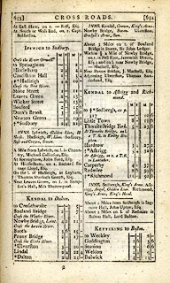 click to enlarge click to enlargeC38653.jpg page 653-654 "KENDAL to Dalton" item:- JandMN : 228.2 Image © see bottom of page |
|||
|
|
||||
| evidence:- | old strip map:- CTC 1911 (Roads) |
|||
| source data:- | Page 81 of Cyclists' Touring Club British Road Book new series vol.6, edited by F
B Sandford, published by Thomas Nelson and Sons, London etc, 1911.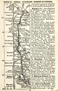 click to enlarge click to enlargeCTC281.jpg Strip road map, route 36, Kendal Ulverston Barrow-in-Furness, scale roughly 5 miles to 1 inch. Together with an itinerary and gradient diagram. item:- JandMN : 491.81 Image © see bottom of page |
|||
|
|
||||
| evidence:- | old strip map:- Geographia 1925 |
|||
| source data:- | Road book, with road strip maps and gradient diagrams, Premier Road Book of Great
Britain, by Alexander Gross and F Waite-Browne, published by Geographia, 55 Fleet
Street, London, about 1925?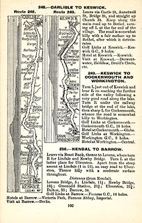 click to enlarge click to enlargeGE1102.jpg "250. - KENDAL TO BARROW." item:- Hampshire Museums : B1990.161.4 Image © see bottom of page |
|||
|
|
||||
| places:- |
|
|||
|
||||
|
||||
|
||||
Lakes Guides menu.