 Old Cumbria Gazetteer
 |
 |
|
| toll gate, Burton-in-Kendal | ||
| gone | ||
| site name:- | road, Lancaster to Kendal | |
| locality:- | Burton-in-Kendal | |
| civil parish:- | Burton-in-Kendal (formerly Westmorland) | |
| county:- | Cumbria | |
| locality type:- | toll gate (site) | |
| coordinates:- | SD52947610 | |
| 1Km square:- | SD5276 | |
| 10Km square:- | SD57 | |
| references:- | OS County Series |
|
|
|
||
| evidence:- | old map:- OS County Series (Wmd 47 13) |
|
| source data:- | Maps, County Series maps of Great Britain, scales 6 and 25
inches to 1 mile, published by the Ordnance Survey, Southampton,
Hampshire, from about 1863 to 1948. "T.P." line across road |
|
|
|
||
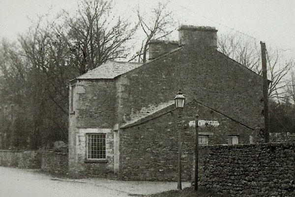 BWJ83.jpg with street lamp and fingerpost courtesy of the local history society |
||
|
|
||
 Lakes Guides menu.