 Old Cumbria Gazetteer
 |
 |
|
| school, Garrigill (2) | ||
| locality:- | Garrigill (near) | |
| civil parish:- | Alston Moor (formerly Cumberland) | |
| county:- | Cumbria | |
| locality type:- | school | |
| coordinates:- | NY74494153 | |
| 1Km square:- | NY7441 | |
| 10Km square:- | NY74 | |
| references:- | OS County Series |
|
|
|
||
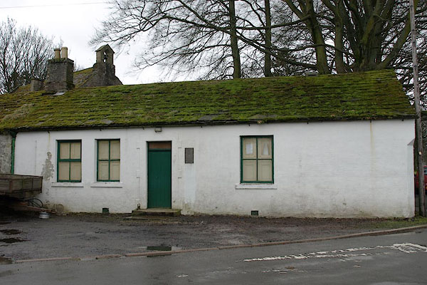 BSJ54.jpg (taken 26.3.2010) 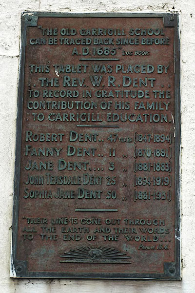 BSJ55.jpg Recent plaque:- ""THE OLD GARRIGILL SCHOOL / CAN BE TRACED BACK SINCE BEFORE / A.D. 1685" LOG BOOK / ..." (taken 26.3.2010) |
||
|
|
||
| evidence:- | old map:- OS County Series (Cmd 42 6) |
|
| source data:- | Maps, County Series maps of Great Britain, scales 6 and 25
inches to 1 mile, published by the Ordnance Survey, Southampton,
Hampshire, from about 1863 to 1948. "Endowed School" |
|
|
|
||
 Lakes Guides menu.