 Old Cumbria Gazetteer
 |
 |
|
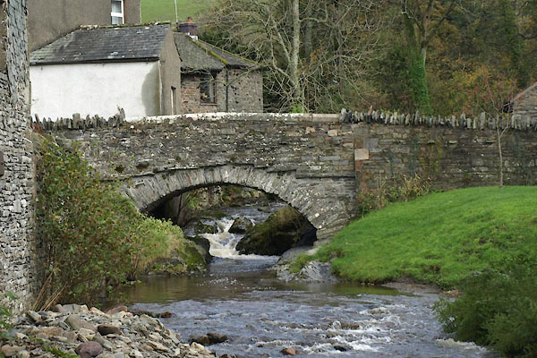
| Boonbeck Bridge, High Lorton | ||
| Boonbeck Bridge | ||
| site name:- | Whit Beck | |
| locality:- | High Lorton | |
| civil parish:- | Lorton (formerly Cumberland) | |
| county:- | Cumbria | |
| locality type:- | bridge | |
| coordinates:- | NY16152551 | |
| 1Km square:- | NY1625 | |
| 10Km square:- | NY12 | |
| references:- | Listed Buildings 2010 |
|
|
|
||
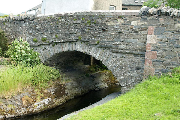 BQW33.jpg (taken 25.6.2009) 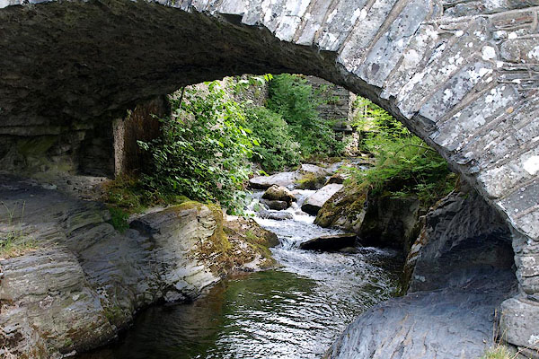 BQW34.jpg (taken 25.6.2009) |
||
|
|
||
| evidence:- | probably old map:- Bell 1892 placename:- High Lorton Bridge placename:- Lorton Bridge, High |
|
| source data:- | Map, colour lithograph, Road Map of Cumberland, by George Joseph
Bell, scale about 2.5 miles to 1 inch, printed by Charles
Thurnam and Sons, Carlisle, Cumberland, 1892.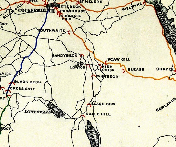 BEL9NY12.jpg "HIGH LORTON" bridge symbol Road map of Cumberland showing County Bridges item:- Carlisle Library : Map 38 Image © Carlisle Library |
|
|
|
||
| evidence:- | database:- Listed Buildings 2010 placename:- Boonbeck Bridge |
|
| source data:- | courtesy of English Heritage "BOONBECK BRIDGE / / / LORTON / ALLERDALE / CUMBRIA / II / 72687 / NY1615325514" |
|
| source data:- | courtesy of English Heritage "Roadbridge. Early C19. Split slate rubble. Single segmental arch with solid rebuilt parapets. Listed for group value with Corner Cottage, Nutshell and Yan Yak." |
|
|
|
||
 BVP08.jpg View of river. (taken 1.11.2011) |
||
|
|
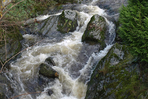
||
 BVO99.jpg (taken 1.11.2011) |
||
|
|
||
 Lakes Guides menu.