 Old Cumbria Gazetteer
 |
 |
|
| Dash Farm, Ireby | ||
| Dash Farm | ||
| locality:- | Dash | |
| civil parish:- | Ireby (formerly Cumberland) | |
| county:- | Cumbria | |
| locality type:- | buildings | |
| coordinates:- | NY26833215 | |
| 1Km square:- | NY2632 | |
| 10Km square:- | NY23 | |
| references:- | Listed Buildings 2010 |
|
|
|
||
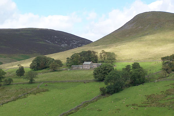 BVE88.jpg (taken 8.8.2011) 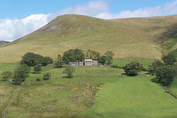 BVE89.jpg (taken 8.8.2011) |
||
|
|
||
| evidence:- | old map:- OS County Series (Cmd 47 14) placename:- Dash |
|
| source data:- | Maps, County Series maps of Great Britain, scales 6 and 25
inches to 1 mile, published by the Ordnance Survey, Southampton,
Hampshire, from about 1863 to 1948. |
|
|
|
||
| evidence:- | old map:- Donald 1774 (Cmd) placename:- Dash |
|
| source data:- | Map, hand coloured engraving, 3x2 sheets, The County of Cumberland, scale about 1
inch to 1 mile, by Thomas Donald, engraved and published by Joseph Hodskinson, 29
Arundel Street, Strand, London, 1774.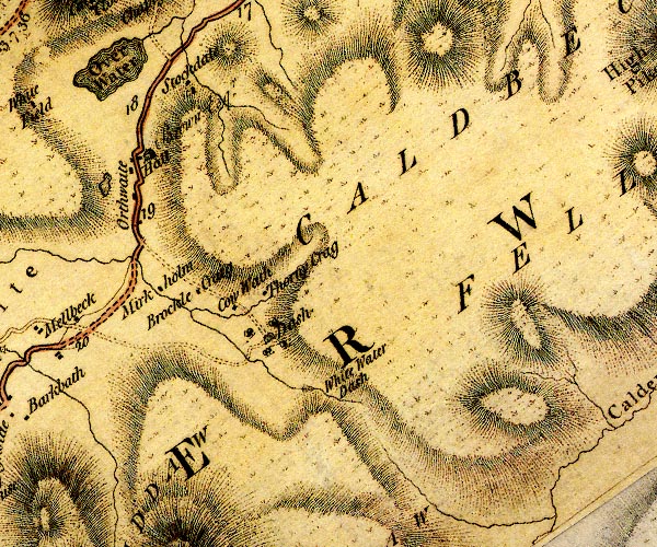 D4NY23SE.jpg "Dash" house item:- Carlisle Library : Map 2 Image © Carlisle Library |
|
|
|
||
| evidence:- | old map:- Otley 1818 placename:- Dash |
|
| source data:- | Map, uncoloured engraving, The District of the Lakes,
Cumberland, Westmorland, and Lancashire, scale about 4 miles to
1 inch, by Jonathan Otley, 1818, engraved by J and G Menzies,
Edinburgh, Scotland, published by Jonathan Otley, Keswick,
Cumberland, et al, 1833.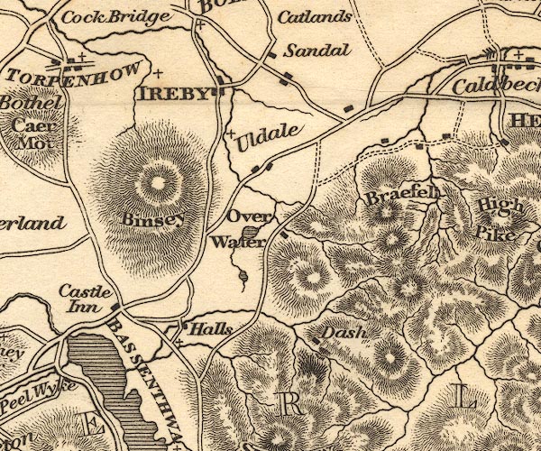 OT02NY23.jpg item:- JandMN : 48.1 Image © see bottom of page |
|
|
|
||
| evidence:- | database:- Listed Buildings 2010 placename:- Dash Farm |
|
| source data:- | courtesy of English Heritage "DASH FARMHOUSE AND ADJOINING BARN/BYRE / / / IREBY AND ULDALE / ALLERDALE / CUMBRIA / II / 72425 / NY2683232155" |
|
|
|
||
 Lakes Guides menu.