 Old Cumbria Gazetteer
 |
 |
|
| Green House, Shap | ||
| Green House | ||
| Green House Farm | ||
| Street:- | Main Street | |
| locality:- | Shap | |
| civil parish:- | Shap (formerly Westmorland) | |
| county:- | Cumbria | |
| locality type:- | buildings | |
| coordinates:- | NY56411447 | |
| 1Km square:- | NY5614 | |
| 10Km square:- | NY51 | |
| references:- | Listed Buildings 2010 |
|
|
|
||
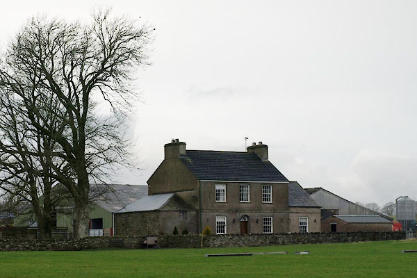 BVS71.jpg (taken 2.12.2011) |
||
|
|
||
| evidence:- | old map:- OS County Series (Wmd 14 14) placename:- Green House |
|
| source data:- | Maps, County Series maps of Great Britain, scales 6 and 25
inches to 1 mile, published by the Ordnance Survey, Southampton,
Hampshire, from about 1863 to 1948. |
|
|
|
||
| evidence:- | database:- Listed Buildings 2010 placename:- Green House |
|
| source data:- | courtesy of English Heritage "GREEN HOUSE WITH PAVILIONS / / MAIN STREET / SHAP / EDEN / CUMBRIA / II / 74177 / NY5641114472" |
|
|
|
||
 Lakes Guides menu.