 Old Cumbria Gazetteer
 |
 |
|
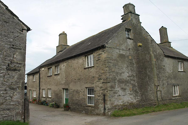
| High House Farm, Natland | ||
| High House Farm | ||
| High House | ||
| Street:- | Helm Lane | |
| locality:- | Natland | |
| civil parish:- | Natland (formerly Westmorland) | |
| county:- | Cumbria | |
| locality type:- | buildings | |
| coordinates:- | SD52348891 | |
| 1Km square:- | SD5288 | |
| 10Km square:- | SD58 | |
| references:- | Listed Buildings 2010 |
|
|
|
||
 BXC98.jpg (taken 15.8.2012) 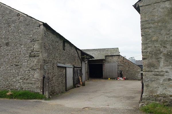 BXC99.jpg (taken 15.8.2012) |
||
|
|
||
| evidence:- | old map:- OS County Series (Wmd 38 16) placename:- High House placename:- House, High |
|
| source data:- | Maps, County Series maps of Great Britain, scales 6 and 25
inches to 1 mile, published by the Ordnance Survey, Southampton,
Hampshire, from about 1863 to 1948. |
|
|
|
||
| evidence:- | database:- Listed Buildings 2010 placename:- High House Farm |
|
| source data:- | courtesy of English Heritage "HIGH HOUSE FARMHOUSE / / HELM LANE / NATLAND / SOUTH LAKELAND / CUMBRIA / II / 76452 / SD5234388912" |
|
|
|
||
| evidence:- | database:- Listed Buildings 2010 |
|
| source data:- | courtesy of English Heritage "BARN TO EAST OF HIGH HOUSE FARMHOUSE / / HELM LANE / NATLAND / SOUTH LAKELAND / CUMBRIA / II / 76453 / SD5233188917" |
|
|
|
||
 Lakes Guides menu.