 Old Cumbria Gazetteer
 |
 |
|
| High Side, Embleton | ||
| High Side | ||
| civil parish:- | Embleton (formerly Cumberland) | |
| county:- | Cumbria | |
| locality type:- | buildings | |
| coordinates:- | NY16332856 | |
| 1Km square:- | NY1628 | |
| 10Km square:- | NY12 | |
| references:- | Listed Buildings 2010 |
|
|
|
||
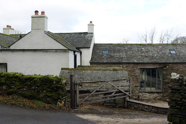 BVY38.jpg (taken 24.2.2012) 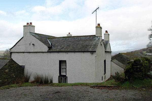 BVY37.jpg (taken 24.2.2012) |
||
|
|
||
| evidence:- | old map:- Donald 1774 (Cmd) placename:- High Side |
|
| source data:- | Map, hand coloured engraving, 3x2 sheets, The County of Cumberland, scale about 1
inch to 1 mile, by Thomas Donald, engraved and published by Joseph Hodskinson, 29
Arundel Street, Strand, London, 1774.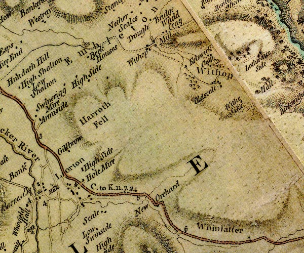 D4NY12NE.jpg "High Side" block or blocks, labelled in lowercase; a hamlet or just a house item:- Carlisle Library : Map 2 Image © Carlisle Library |
|
|
|
||
| evidence:- | database:- Listed Buildings 2010 placename:- High Side item:- date stone (1771); date stone (1747) |
|
| source data:- | courtesy of English Heritage "HIGH SIDE AND BARN ADJOINING / / / EMBLETON / ALLERDALE / CUMBRIA / II / 72652 / NY1632828571" |
|
|
|
||
 Lakes Guides menu.