 Old Cumbria Gazetteer
 |
 |
|
| Hind Keld East, Garsdale | ||
| Hind Keld East | ||
| locality:- | Hind Keld | |
| locality:- | Garsdale valley | |
| civil parish:- | Garsdale (formerly Yorkshire) | |
| county:- | Cumbria | |
| locality type:- | buildings | |
| coordinates:- | SD71249122 | |
| 1Km square:- | SD7191 | |
| 10Km square:- | SD79 | |
|
|
||
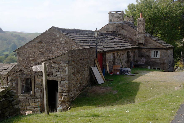 CBS62.jpg (taken 19.9.2014) 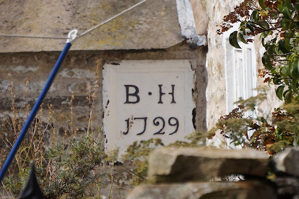 CBS64.jpg Date stone:- "B.H / 1729 / [ ]" (taken 19.9.2014) |
||
|
|
||
| evidence:- | old map:- OS County Series (Yrk 64 2) placename:- Hind Keld East |
|
| source data:- | Maps, County Series maps of Great Britain, scales 6 and 25
inches to 1 mile, published by the Ordnance Survey, Southampton,
Hampshire, from about 1863 to 1948. |
|
|
|
||
| evidence:- | database:- Listed Buildings 2010 placename:- Hind Keld East item:- date stone (1729) |
|
| source data:- | courtesy of English Heritage "HIND KELD EAST / / HAWES ROAD / GARSDALE / SOUTH LAKELAND / CUMBRIA / II / 484459 / SD7123791216" |
|
|
|
||
 CBS63.jpg (taken 19.9.2014) 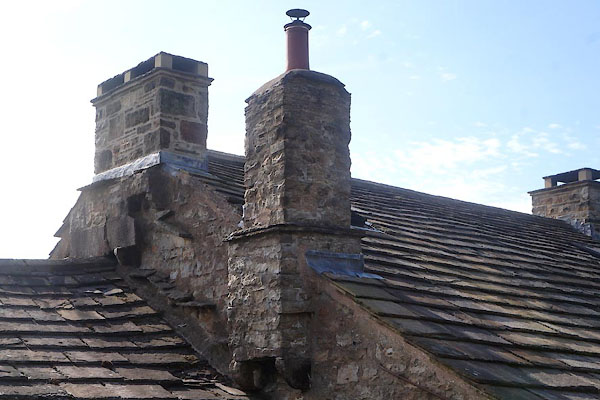 CBS67.jpg Chimneys. (taken 19.9.2014) 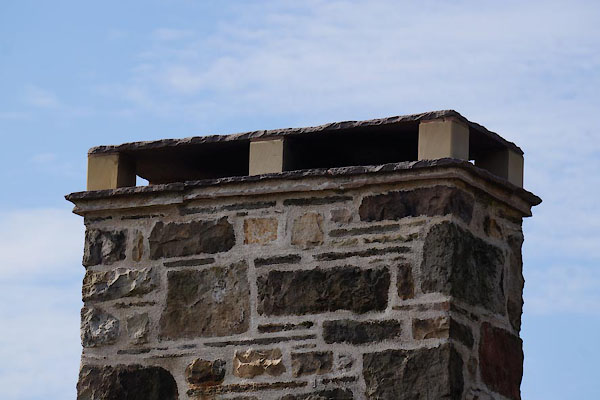 CBS65.jpg Chimney top. (taken 19.9.2014)  CBS66.jpg Sign. (taken 19.9.2014) |
||
|
|
||
 Lakes Guides menu.