 Old Cumbria Gazetteer
 |
 |
|
| Lane Foot Farm, Above Derwent | ||
| Lane Foot Farm | ||
| Lanefoot Farm | ||
| civil parish:- | Above Derwent (formerly Cumberland) | |
| county:- | Cumbria | |
| locality type:- | buildings | |
| coordinates:- | NY22782458 | |
| 1Km square:- | NY2224 | |
| 10Km square:- | NY22 | |
|
|
||
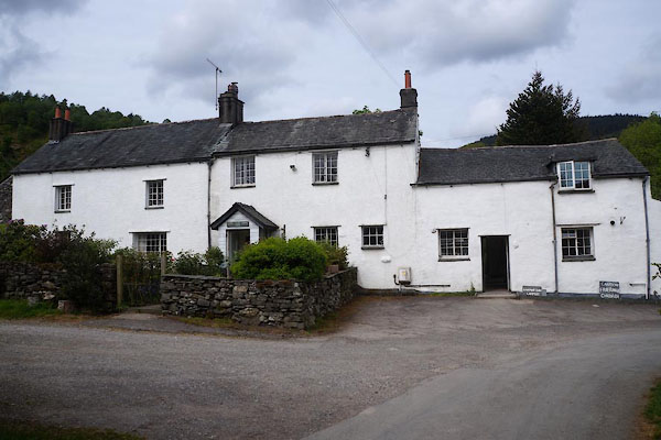 CGC73.jpg (taken 19.5.2017) |
||
|
|
||
| evidence:- | old map:- OS County Series (Cmd 63 4) placename:- Lanefoot |
|
| source data:- | Maps, County Series maps of Great Britain, scales 6 and 25
inches to 1 mile, published by the Ordnance Survey, Southampton,
Hampshire, from about 1863 to 1948. |
|
|
|
||
| evidence:- | old map:- Crosthwaite 1783-94 (Bas) placename:- Lonning Foot |
|
| source data:- | Map, uncoloured engraving, An Accurate Map of Broadwater or
Bassenthwaite Lake, scale about 3 inches to 1 mile, by Peter
Crosthwaite, Keswick, Cumberland, 1783, version published 1800.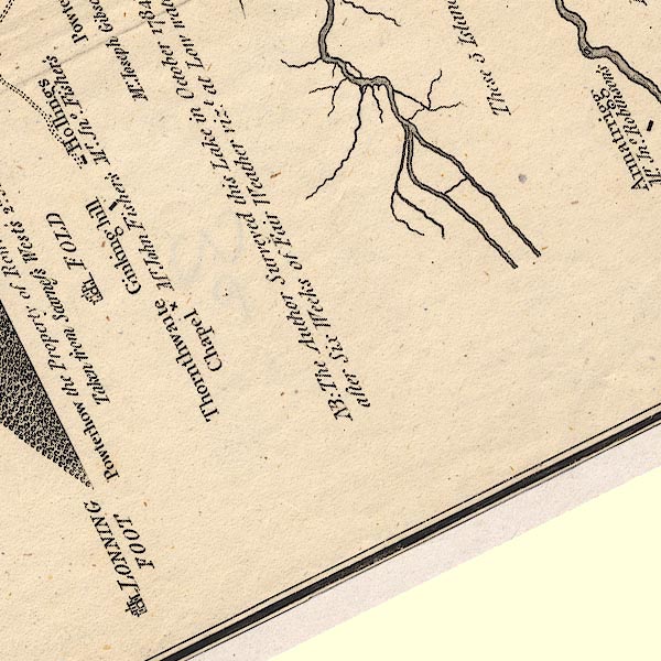 CT6NY22H.jpg "LONNING FOOT" Marked by a circle, buildings and tower symbol. item:- Armitt Library : 1959.191.4 Image © see bottom of page |
|
|
|
||
| evidence:- | perhaps old print:- placename:- Lane Foot item:- chimney |
|
| source data:- | Print, Lane Foot, drawn and engraved by William Green, Ambleside, Westmorland, 1809.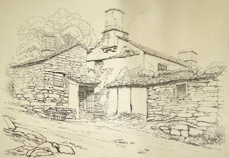 click to enlarge click to enlargePR1269.jpg Whitewashed stone farmhouse built on an incline; the road beside it slopes from top left to lower right of composition. Perhaps Lane Foot Farm, Above Derwent? printed at bottom centre:- "LANE FOOT Published Ambleside Augst 1st 1809 by W. Green" item:- Tullie House Museum : 1978.108.92.8 Image © Tullie House Museum |
|
|
|
||
| evidence:- | database:- Listed Buildings 2010 placename:- Lane Foot Farm |
|
| source data:- | courtesy of English Heritage "LANE FOOT FARMHOUSE / / / ABOVE DERWENT / ALLERDALE / CUMBRIA / II / 72095 / NY2278424583" |
|
|
|
||
 CGC74.jpg (taken 19.5.2017) |
||
|
|
||
 Lakes Guides menu.