 Old Cumbria Gazetteer
 |
 |
|
| Natland Mill Beck Farm, Natland | ||
| Natland Mill Beck Farm | ||
| Natland Beck Farm | ||
| Street:- | Natland Mill Beck Lane | |
| civil parish:- | Natland (formerly Westmorland) | |
| county:- | Cumbria | |
| locality type:- | buildings | |
| coordinates:- | SD52039075 | |
| 1Km square:- | SD5290 | |
| 10Km square:- | SD59 | |
| references:- | Listed Buildings 2010 |
|
|
|
||
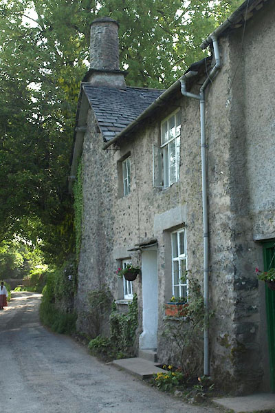 BYM35.jpg (taken 7.6.2013) 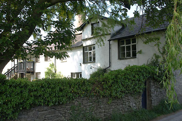 BYM34.jpg (taken 7.6.2013) |
||
|
|
||
| evidence:- | probablyprobably old map:- OS County Series (Wmd 38 12) placename:- Natland Millbeck |
|
| source data:- | Maps, County Series maps of Great Britain, scales 6 and 25
inches to 1 mile, published by the Ordnance Survey, Southampton,
Hampshire, from about 1863 to 1948. |
|
|
|
||
| evidence:- | old map:- Jefferys 1770 (Wmd) placename:- Mill Beck |
|
| source data:- | Map, 4 sheets, The County of Westmoreland, scale 1 inch to 1
mile, surveyed 1768, and engraved and published by Thomas
Jefferys, London, 1770.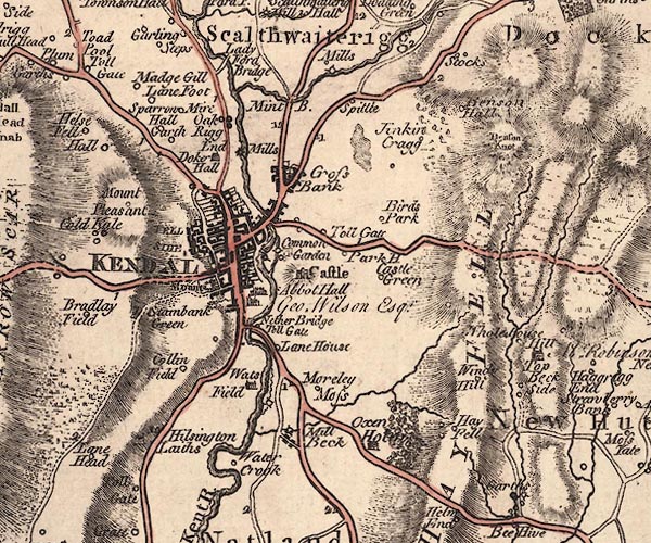 J5SD59SW.jpg "Mill Beck" blocks, labelled in italic lowercase text; settlement, village? item:- National Library of Scotland : EME.s.47 Image © National Library of Scotland |
|
|
|
||
| evidence:- | old map:- Cary 1789 (edn 1805) placename:- Mill Beck |
|
| source data:- | Map, uncoloured engraving, Westmoreland, scale about 2.5 miles
to 1 inch, by John Cary, London, 1789; edition 1805.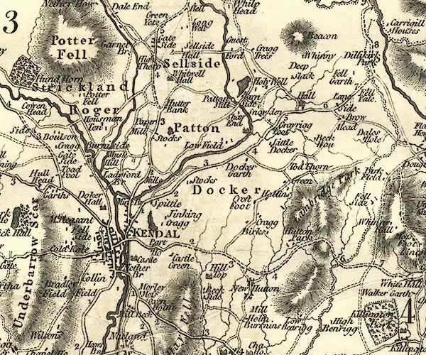 CY24SD59.jpg "Mill Beck" block/s, labelled in italic lowercase; house, or hamlet item:- JandMN : 129 Image © see bottom of page |
|
|
|
||
| evidence:- | database:- Listed Buildings 2010 placename:- Natland Mill Beck Farm |
|
| source data:- | courtesy of English Heritage "NATLAND MILL BECK FARMHOUSE AND ATTACHED COTTAGE / / NATLAND MILL BECK LANE / NATLAND / SOUTH LAKELAND / CUMBRIA / II / 76459 / SD5203690754" |
|
|
|
||
 Lakes Guides menu.