 Old Cumbria Gazetteer
 |
 |
|
| Salkeld Gate, Plumpton | ||
| Salkeld Gate | ||
| locality:- | Plumpton | |
| civil parish:- | Hesket (formerly Cumberland) | |
| county:- | Cumbria | |
| locality type:- | buildings | |
| coordinates:- | NY49743709 (??) | |
| 1Km square:- | NY4937 | |
| 10Km square:- | NY43 | |
| references:- | Listed Buildings 2010 |
|
|
|
||
| evidence:- | old map:- Berry 1679 placename:- Saucold Yate |
|
| source data:- | Road map, diagram, The Grand Roads of England, engraved by John
Rich, made and published by William Berry, at the Sign of the
Globe, London, 1679. "Saucold-Yate" |
|
|
|
||
| evidence:- | old map:- Donald 1774 (Cmd) placename:- Salkeld Yate |
|
| source data:- | Map, hand coloured engraving, 3x2 sheets, The County of Cumberland, scale about 1
inch to 1 mile, by Thomas Donald, engraved and published by Joseph Hodskinson, 29
Arundel Street, Strand, London, 1774.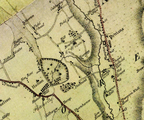 D4NY43NE.jpg "Salkeld Yate" block or blocks, labelled in lowercase; a hamlet or just a house item:- Carlisle Library : Map 2 Image © Carlisle Library |
|
|
|
||
| evidence:- | old map:- Wallis 1810 (Cmd) placename:- Salkeld Yate |
|
| source data:- | Road map, hand coloured engraving, Cumberland, scale about 16
miles to 1 inch, by James Wallis, 77 Berwick Stree, Soho,
London, 1810. click to enlarge click to enlargeWL13.jpg "Salkeld Yate" village, hamlet, house, ... item:- Dove Cottage : 2009.81.10 Image © see bottom of page |
|
|
|
||
| evidence:- | database:- Listed Buildings 2010 placename:- Salkeld Gate |
|
| source data:- | courtesy of English Heritage "SALKELD GATE / / / HESKET / EDEN / CUMBRIA / II / 73904 / NY4976837184" |
|
|
|
||
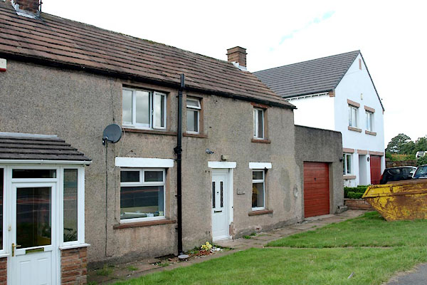 BYX65.jpg (taken 2.8.2013) |
||
| This is the building at the ngr given by the listed building description, NY49763718;
it doesn't match the listed building description. |
||
|
|
||
 Lakes Guides menu.