 Old Cumbria Gazetteer
 |
 |
|
| Shap Abbey Farm, Shap Rural | ||
| Shap Abbey Farm | ||
| locality:- | Shap Abbey | |
| civil parish:- | Shap Rural (formerly Westmorland) | |
| county:- | Cumbria | |
| locality type:- | buildings | |
| coordinates:- | NY54831517 | |
| 1Km square:- | NY5415 | |
| 10Km square:- | NY51 | |
|
|
||
 BTF45.jpg (taken 22.7.2005) |
||
|
|
||
| evidence:- | old map:- OS County Series (Wmd 14 13) placename:- Shap Abbey |
|
| source data:- | Maps, County Series maps of Great Britain, scales 6 and 25
inches to 1 mile, published by the Ordnance Survey, Southampton,
Hampshire, from about 1863 to 1948. |
|
|
|
||
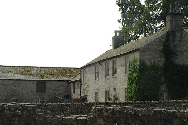
| evidence:- | database:- Listed Buildings 2010 placename:- Shap Abbey Farm |
|
| source data:- | courtesy of English Heritage "SHAP ABBEY FARMHOUSE WITH ATTACHED BYRE RANGE / / / SHAP RURAL / EDEN / CUMBRIA / II / 74187 / NY5480215174" |
|
|
|
||
| evidence:- | database:- Listed Buildings 2010 |
|
| source data:- | courtesy of English Heritage "WAGON SHED WITH HAY LOFT TO SOUTH EAST OF SHAP ABBEY FARMHOUSE / / / SHAP RURAL / EDEN / CUMBRIA / II / 74188 / NY5483115170" |
|
|
|
||
| evidence:- | database:- Listed Buildings 2010 |
|
| source data:- | courtesy of English Heritage "SCULLERY RANGE TO EAST OF SHAP ABBEY FARMHOUSE / / / SHAP RURAL / EDEN / CUMBRIA / II / 74189 / NY5482915185" |
|
|
|
||
 Lakes Guides menu.