 Old Cumbria Gazetteer
 |
 |
|
| Hetherside Mill, Kirklinton Middle | ||
| Hetherside Mill | ||
| site name:- | Hether Burn | |
| locality:- | Hether Mill | |
| civil parish:- | Kirklinton Middle (formerly Cumberland) | |
| county:- | Cumbria | |
| locality type:- | buildings | |
| locality type:- | water mill (ex) | |
| locality type:- | mill (ex) | |
| locality type:- | corn mill (ex) | |
| coordinates:- | NY43546617 | |
| 1Km square:- | NY4366 | |
| 10Km square:- | NY46 | |
| references:- | Listed Buildings 2010 |
|
|
|
||
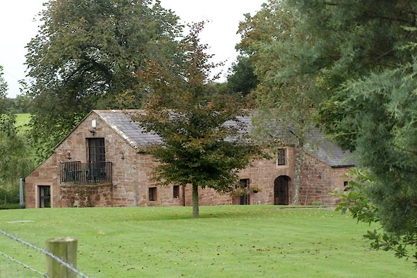 BZJ45.jpg (taken 27.9.2013) 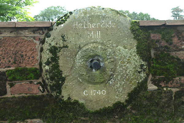 BZJ46.jpg Sign. (taken 27.9.2013) |
||
|
|
||
| evidence:- | old map:- OS County Series (Cmd 11 9) placename:- Hetherside Mill |
|
| source data:- | Maps, County Series maps of Great Britain, scales 6 and 25
inches to 1 mile, published by the Ordnance Survey, Southampton,
Hampshire, from about 1863 to 1948. "Hetherside Mill (Corn) / Weir / Sluice" and mill race |
|
|
|
||
| evidence:- | old map:- Donald 1774 (Cmd) |
|
| source data:- | Map, hand coloured engraving, 3x2 sheets, The County of Cumberland, scale about 1
inch to 1 mile, by Thomas Donald, engraved and published by Joseph Hodskinson, 29
Arundel Street, Strand, London, 1774.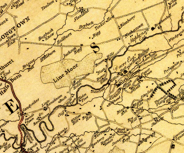 D4NY46NW.jpg circle with rays, mill wheel; a water mill at Black Hill item:- Carlisle Library : Map 2 Image © Carlisle Library |
|
|
|
||
| evidence:- | database:- Listed Buildings 2010 |
|
| source data:- | courtesy of English Heritage "FORMER WATERMILL AT HETHER MILL / / / KIRKLINTON MIDDLE / CARLISLE / CUMBRIA / II / 461959 / NY4354566167" |
|
|
|
||
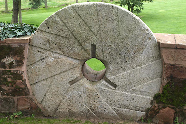 BZJ47.jpg Mill stone. (taken 27.9.2013) |
||
|
|
||
 Lakes Guides menu.