 Old Cumbria Gazetteer
 |
 |
|
| Wattsfield, Kendal | ||
| Wattsfield | ||
| Street:- | Wattsfield Lane | |
| locality:- | Kendal | |
| civil parish:- | Kendal (formerly Westmorland) | |
| county:- | Cumbria | |
| locality type:- | locality | |
| locality type:- | buildings | |
| coordinates:- | SD51689129 | |
| 1Km square:- | SD5191 | |
| 10Km square:- | SD59 | |
| SummaryText:- | cf Wattsfield Road | |
| references:- | Hearth Tax 1675 |
|
|
|
||
| evidence:- | old map:- OS County Series (Wmd 38 12) placename:- Wathfield |
|
| source data:- | Maps, County Series maps of Great Britain, scales 6 and 25
inches to 1 mile, published by the Ordnance Survey, Southampton,
Hampshire, from about 1863 to 1948. |
|
|
|
||
| evidence:- | hearth tax returns:- Hearth Tax 1675 placename:- Watch field |
|
| source data:- | Records, hearth tax survey returns, Westmorland, 1674/75. "Watch field" in "Nethergraveship" |
|
|
|
||
| evidence:- | old map:- Jefferys 1770 (Wmd) placename:- Wats Field |
|
| source data:- | Map, 4 sheets, The County of Westmoreland, scale 1 inch to 1
mile, surveyed 1768, and engraved and published by Thomas
Jefferys, London, 1770.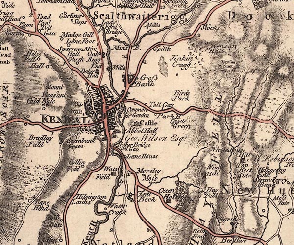 J5SD59SW.jpg "Wats Field" house item:- National Library of Scotland : EME.s.47 Image © National Library of Scotland |
|
|
|
||
| evidence:- | database:- Listed Buildings 2010 placename:- Wattsfield Farm |
|
| source data:- | courtesy of English Heritage "WATTSFIELD FARMHOUSE AND COTTAGE / / WATTSFIELD LANE / KENDAL / SOUTH LAKELAND / CUMBRIA / II[star] / 75519 / SD5168691291" |
|
|
|
||
| evidence:- | database:- Listed Buildings 2010 |
|
| source data:- | courtesy of English Heritage "GATE PIERS AND FORECOURT WALL TO WEST OF WATTSFIELD FARMHOUSE / / WATTSFIELD LANE / KENDAL / SOUTH LAKELAND / CUMBRIA / II / 75520 / SD5166891292" |
|
|
|
||
 Lakes Guides menu.