 Old Cumbria Gazetteer
 |
 |
|
|
| road, Shap to Orton | |||
| Shap to Orton | |||
| Orton to Shap | |||
| civil parish:- | Shap (formerly Westmorland) | ||
| civil parish:- | Shap Rural (formerly Westmorland) | ||
| civil parish:- | Crosby Ravensworth (formerly Westmorland) | ||
| civil parish:- | Orton S (formerly Westmorland) | ||
| county:- | Cumbria | ||
| locality type:- | route | ||
| 10Km square:- | NY51 | ||
| 10Km square:- | NY50 | ||
| 10Km square:- | NY60 | ||
|
|
|||
| evidence:- | old map:- Jefferys 1770 (Wmd) |
||
| source data:- | Map, 4 sheets, The County of Westmoreland, scale 1 inch to 1
mile, surveyed 1768, and engraved and published by Thomas
Jefferys, London, 1770.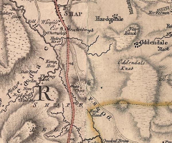 J5NY51SE.jpg "F. S to O 6." 'From Shap to Orton 6 miles.' 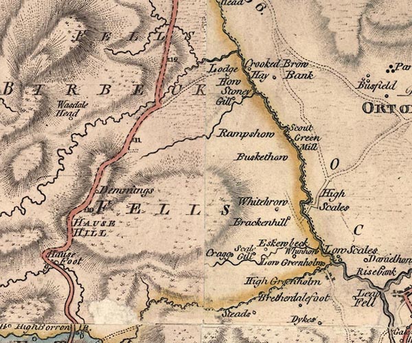 J5NY50NE.jpg 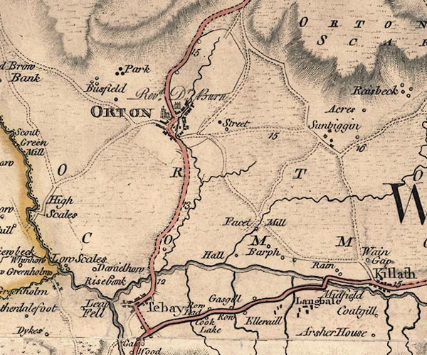 J5NY60NW.jpg double line; road item:- National Library of Scotland : EME.s.47 Images © National Library of Scotland |
||
|
|
|||
| evidence:- | old strip map:- CTC 1911 (Roads) |
||
| source data:- | Page 98 of Cyclists' Touring Club British Road Book new series vol.6, edited by F
B Sandford, published by Thomas Nelson and Sons, London etc, 1911.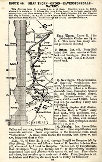 click to enlarge click to enlargeCTC298.jpg Strip road map, route 46, Shap Thorn Orton Ravenstonedale Nateby, scale roughly 5 miles to 1 inch. Together with an itinerary and gradient diagram. item:- JandMN : 491.98 Image © see bottom of page |
||
|
|
|||
 Act of Parliament Act of Parliament |
|||
|
|
|||
| places:- |  Shap Orton Shap Orton |
||
|
|
|||
Lakes Guides menu.