 Old Cumbria Gazetteer
 |
 |
|
| included in:- |
 Sedgwick Trail, Garsdale Sedgwick Trail, Garsdale |
|
| Sedgwick Trail 10, Garsdale | ||
| site name:- | Sedgwick Trail | |
| locality:- | Clough River | |
| civil parish:- | Garsdale (formerly Yorkshire) | |
| county:- | Cumbria | |
| locality type:- | trail point | |
| coordinates:- | SD69369149 | |
| 1Km square:- | SD6991 | |
| 10Km square:- | SD69 | |
|
|
||
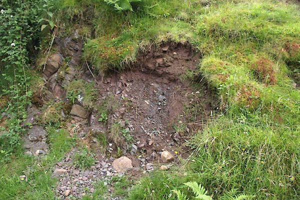 BWY81.jpg View from the marker post. Brathay Flags and conglomerate. (taken 27.7.2012) 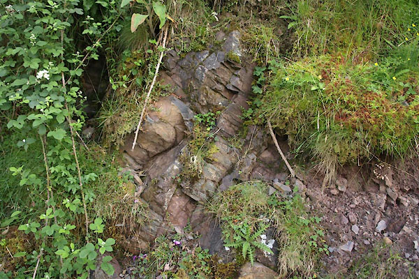 BWY82.jpg Brathay Flags and conglomerate. (taken 27.7.2012) |
||
| The fine grained mudstones on the left, upstream, are Brathay Flags, deposited in
the Silurian period about 435 Myrs ago, dip about 62 degrees. Downstream, on the right,
is a conglomerate at a shallow dip angle (very hard to see), deposited much later
after the brathay flags had been tilted and eroded. It was probably laid down in desert
conditions, perhaps in the Devonian or late Carboniferous period. |
||
|
|
||
Lakes Guides menu.