 Old Cumbria Gazetteer
 |
 |
|
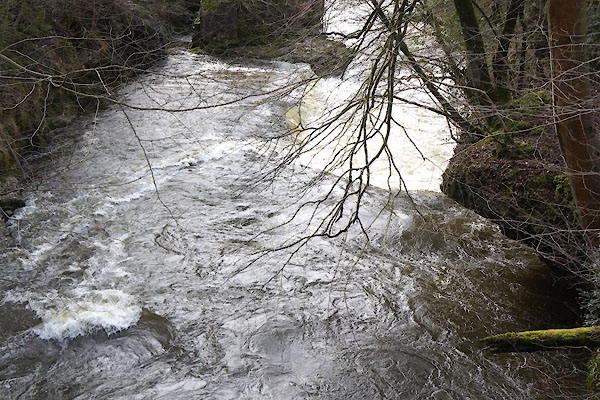
| waterfall, Sedgwick (2) | ||
| site name:- | Kent, River | |
| locality:- | Force Bridge | |
| civil parish:- | Sedgwick (formerly Westmorland) | |
| civil parish:- | Helsington (formerly Westmorland) | |
| county:- | Cumbria | |
| locality type:- | waterfall | |
| coordinates:- | SD50748680 | |
| 1Km square:- | SD5086 | |
| 10Km square:- | SD58 | |
|
|
||
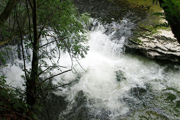 BXD34.jpg (taken 15.8.2012) 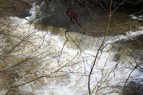 CCP66.jpg (taken 13.3.2015) |
||
|
|
||
| evidence:- | old painting:- |
|
| source data:- | Painting, watercolour, View on the River Kent, Force Bridge, Sedgwick, Westmorland,
by Paul Sandby, 1760s-70s.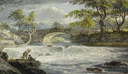 click to enlarge click to enlargePR0811.jpg Foreshortened view of the small natural weir of a river spanned in centre of composition by a stone bridge. Trees line either bank. item:- Tullie House Museum : 1905.10A.2 Image © Tullie House Museum |
|
|
|
||
| evidence:- | old painting:- |
|
| source data:- | Painting, watercolour, View of Force Bridge and a Fall of the River Kent Five Miles
South of Kendal, Sedgwick, Westmorland, by Paul Sandby, 1760s-70s.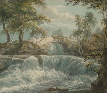 click to enlarge click to enlargePR0810.jpg Foreshortened view of the small natural weir of a river spanned in centre of composition by a stone bridge. Trees line either bank. inscribed at lower edge:- "View of Force Bridge and a Fall of the River Kent 5 miles South of Kendal" item:- Tullie House Museum : 1905.10A.1 Image © Tullie House Museum |
|
|
|
||
| evidence:- | old map:- Jefferys 1770 (Wmd) |
|
| source data:- | Map, 4 sheets, The County of Westmoreland, scale 1 inch to 1
mile, surveyed 1768, and engraved and published by Thomas
Jefferys, London, 1770.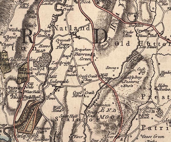 J5SD58NW.jpg "Waterfalls" no symbol item:- National Library of Scotland : EME.s.47 Image © National Library of Scotland |
|
|
|
||
 CCP65.jpg (taken 13.3.2015) |
||
|
|
||
 Lakes Guides menu.