item:- Hampshire Museums : FA2001.173
image:- © see bottom of page
 POF2Cm.jpg
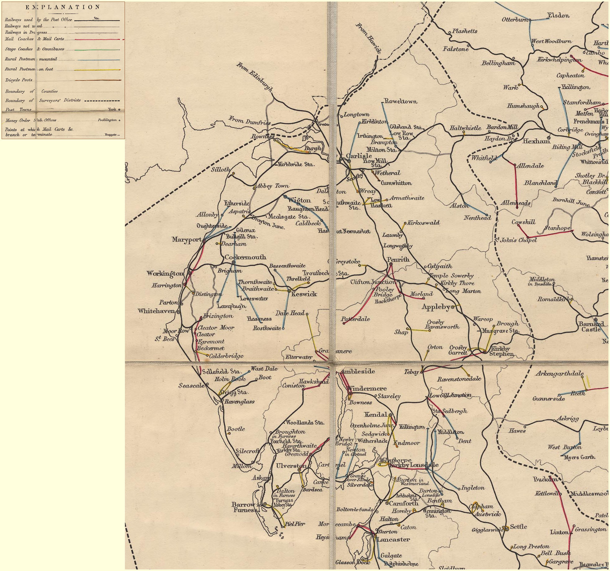
Map, hand coloured engraving, General Post Office Circulation
Map for England and Wales, scale about 1 to 650000, about 10
miles to 1 inch, published by Stanford's Geographical
Establishment, London, 1890.
 Lakes Guides menu.