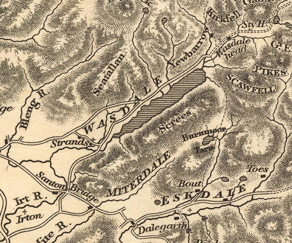
 Otley 1818 NY10


|

|
|
|
gazetteer links places may or may not be labelled on the map |
||

|
-- Blea Tarn |
|
|
|
-- Boot |
|
|
|
-- Burnmoor Tarn |
|
|
|
-- Eel Tarn |
|
|
|
-- Eskdale -- "ESKDALE" |
|
|
|
-- Miterdale -- "MITERDALE" |
|
|
|
-- Nether Wasdale |
|
|
|
-- Santon Bridge |
|
|
|
-- Santon Bridge |
|
|
|
-- Screes, The |
|
|
|
-- Seatallan |
|
|
|
-- Stony Tarn |
|
|
|
-- Wasdale Head |
|
|
|
-- Wast Water |
|
|
|
-- Yewbarrow |
|
|
civil parishes The area roughly includes parts of parishes:- Gosforth Eskdale Ennerdale and Kinniside Nether Wasdale Irton with Santon Muncaster |
||
|
|
||
|
|
Lakes Guides menu. | |