 Saxton 1576 NY55


|

|
|
|
gazetteer links places may or may not be labelled on the map |
||

|
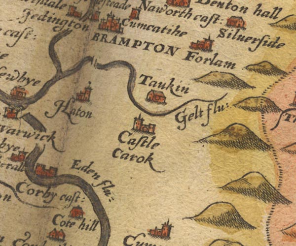
-- Brampton -- "BRAMPTON" |
|
|
|
-- Castle Carrock -- "Castle Carok" |
|
|
|
-- Cote Hill -- "Cote hill" |
|
|
|
-- Cumcatch -- "Cumcatihe" |
|
|
|
-- Eden, River -- "Eden flu:" -- "Eden flu:"
-- "Eden flu:" -- "Eden flu:" |
|
|
|
-- Farlam -- "Forlam" |
|
|
|
-- Gelt, River -- "Gelt flu:" |
|
|
|
-- Hayton -- "Haton" |
|
|
|
-- Irthing, River -- "Irthing flu:" -- "Irthing
flu:" -- "Trout bek" |
|
|
|
-- Low Gelt Bridge |
|
|
|
-- Silver Side -- "Silverside" |
|
|
|
-- Talkin -- "Taukin" |
|
|
civil parishes The area roughly includes parts of parishes:- Castle Carrock Cumrew Midgeholme Cumwhitton Geltsdale Carlatton Hayton Brampton Ainstable Farlam |
||
|
|
||
|
|
Lakes Guides menu. | |