 Lakes Guides, topics
 |
 |
|
||
| boundary stones, Cumbria | ||||
| county:- | Cumbria | |||
| also see:- |  county boundary, Cumbria county boundary, Cumbria |
|||
|
|
||||
| Mere Marks |
||||
| The obvious type of boundary stones to look for are parish and county boundary markers.
But there can be markers of ownership, and markers for turbary (peat cutting) rights,
and so on. Some stones mark more than one sort of boundary. |
||||
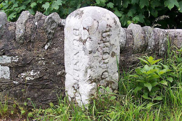 BMG23.jpg - Dunnerdale / Broughton parish boundary, Cumberland, at SD2249071. |
||||
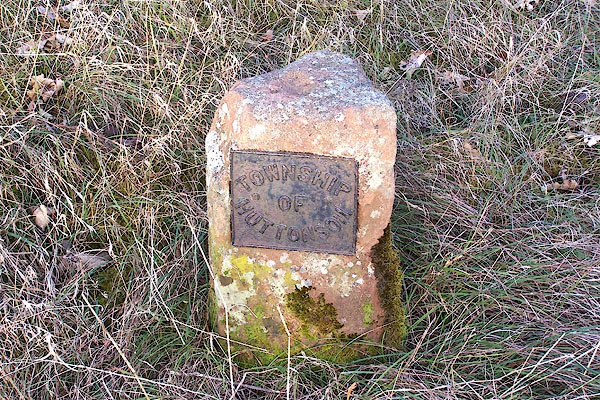 BLP70.jpg - A township was a group of houses, usually a division for the purposes of local administration. In northern counties of England the term continued to be used after The Conquest. |
||||
| hearsay:- | The Justices of the Peace acting within Leath Ward, to the Surveyor of the Township
of Hutton John, 1 August 1848:- |
|||
| hearsay:- |
"[You are hereby required forthwith to erect and fix ... Stones or Posts to mark the
Boundaries of the Highway between your own Liberty, and the Liberties next adjoining,
containing the name of the Township or Parish for which you act; and you are allowed
to charge the reasonable expenses of providing and erecting the same, in your accounts.]" |
|||
|
|
||||
| references:- |
Winchester, Angus: 2000: Discovering Parish Boundaries: Shire Books (Princes Risborough, Buckinghamshire):: ISBN 0 7478 0470 2 Richardson, John: 1985: Local Historians Encyclopedia: Historical Publications (New Barnet, Hertfordshire) Bulmer, T F: 1884: History, Topography and Directory of East Cumberland: Bulmer, T and Co (Manchester, Lancashire) Bulmer, T F: 1885: History, Topography, and Directory of Westmoreland: Bulmer, T and Co (Manchester, Lancashire) |
|||
|
|
||||
Lakes Guides menu.