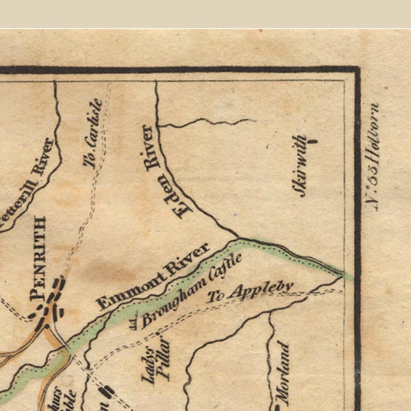
 West 1784 map NY53


|

|
|
|
gazetteer links places may or may not be labelled on the map |
||

|
-- Countess Pillar |
|
|
|
-- Eamont, River |
|
|
|
-- Eden, River |
|
|
|
-- Leith, River |
|
|
|
-- Lowther, River |
|
|
|
-- Skirwith |
|
|
civil parishes The area roughly includes parts of parishes:- Culgaith Penrith Great Salkeld Glassonby Lazonby Hesket Hunsonby Ousby Kirkoswald Langwathby Brougham |
||
|
|
||
|
|
Lakes Guides menu. | |