 Otley 1818 NY33


|

|
|
|
gazetteer links places may or may not be labelled on the map |
||

|
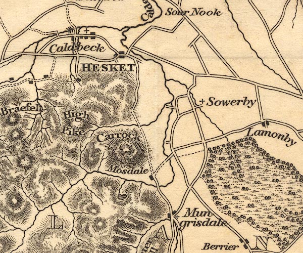
-- Bowscale Tarn |
|
|
|
-- Caldbeck |
|
|
|
-- Carrock Fell |
|
|
|
-- Greystoke Castle |
|
|
|
-- Hesket Newmarket -- "HESKET" |
|
|
|
-- High Pike |
|
|
|
-- Mosedale |
|
|
|
-- Mungrisdale |
|
|
|
-- Sowerby Hall |
|
|
civil parishes The area roughly includes parts of parishes:- Underskiddaw Caldbeck Mungrisdale Castle Sowerby Sebergham Greystoke Skelton |
||
|
|
||
|
|
Lakes Guides menu. | |