 Saxton 1576 NY20


|

|
|
|
gazetteer links places may or may not be labelled on the map |
||

|
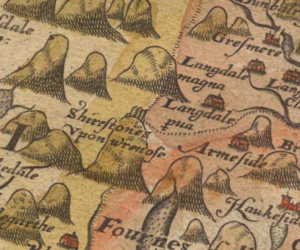
-- Arnside -- "Armeside" |
|
|
|
-- Great Langdale -- "Langdale magna" |
|
|
|
-- Little Langdale -- "Langdale p~va" |
|
|
|
-- Three Shire Stones -- "Shirestones Upon wrenose" |
|
|
|
-- Wrynose Pass -- "wrenose" |
|
|
civil parishes The area roughly includes parts of parishes:- Dunnerdale-with-Seathwaite Eskdale Lakes Ulpha Nether Wasdale Coniston St John's Castlerigg and Wythburn Borrowdale |
||
|
|
||
|
|
Lakes Guides menu. | |