 West 1784 map NY52


|

|
|
|
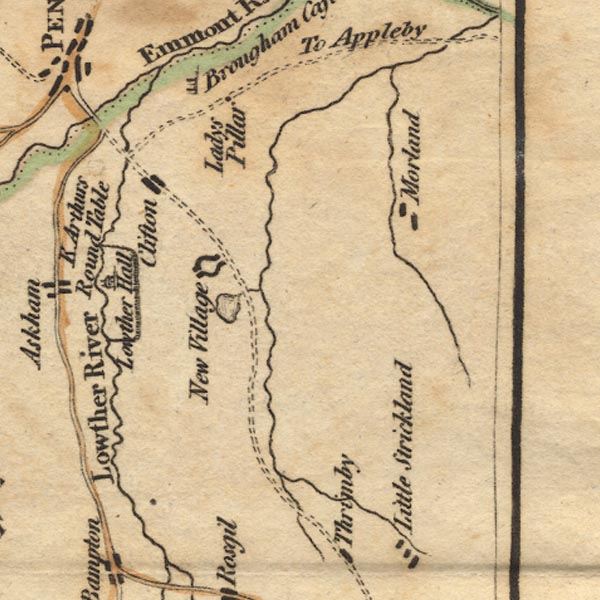
gazetteer links places may or may not be labelled on the map |
||

|
-- Clifton |
|
|
|
-- decoy pond, Lowther |
|
|
|
-- Leith, River |
|
|
|
-- Lowther Castle |
|
|
|
-- Lowther Park |
|
|
|
-- Lowther |
|
|
|
-- Lowther, River |
|
|
|
-- Morland |
|
|
civil parishes The area roughly includes parts of parishes:- Penrith Dacre Askham Barton Sockbridge and Tirril Langwathby Sleagill Little Strickland Culgaith Newby Thrimby Lowther Great Strickland Cliburn Morland Bampton Clifton Yanwath and Eamont Bridge Brougham |
||
|
|
||
|
|
Lakes Guides menu. | |