 Old Cumbria Gazetteer
 |
 |
|
| boundary stone, Longsleddale/Shap Rural (4) | ||
| site name:- | Adam Seat | |
| locality:- | boundary, Longsleddale/Shap Rural | |
| civil parish:- | Longsleddale (formerly Westmorland) | |
| civil parish:- | Shap Rural (formerly Westmorland) | |
| county:- | Cumbria | |
| locality type:- | boundary stone | |
| locality type:- | parish boundary mark | |
| locality type:- | estate boundary mark | |
| coordinates:- | NY47110908 | |
| 1Km square:- | NY4709 | |
| 10Km square:- | NY40 | |
|
|
||
 BJD23.jpg South face letter 'H', roughly 6 inches high H for Harrison, the landowner in Longsleddale parish, to the south. (taken 7.9.2004) 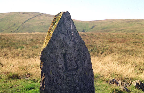 BJD24.jpg North face letter 'L', roughly 6 inches high. L for Lowther, landowner in Shap Rural parish to the north. (taken 7.9.2004) |
||
|
|
||
| evidence:- | map:- OS Six Inch (1956) |
|
| source data:- | Map series, various editions with the national grid, scale about
6 inches to 1 mile, published by the Ordnance Survey,
Southampton, Hampshire, scale 1 to 10560 from 1950s to 1960s,
then 1 to 10000 from 1960s to 2000s, superseded by print on
demand from digital data.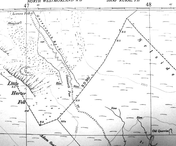 SINY4709.jpg "B.S." |
|
|
|
||
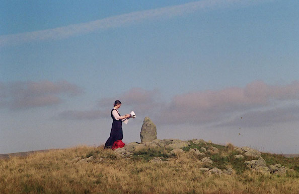 BJD26.jpg Jean on Adam Seat, on a boundary stone search. (taken 7.9.2004) |
||
|
|
||
| :- |
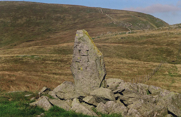
The boundary stone is prominent on the top of Adam Seat. The fence line now misses
the stone, curving by to the north. The north/south faces of the stone are marked:- |
|
| "L / H" |
||
| in neatly serifed letters about 6 inches high. |
||
| The boundary is on a parish boundary between Longsleddale and Shap; but the boundary
distinction is between landowners to north, Lowther in Shap Rural, and south, Harrison
in Longsleddale. |
||
|
|
||
 Lakes Guides menu.