 Old Cumbria Gazetteer
 |
 |
|
| Croasdale Bridge, Croasdale | ||
| Croasdale Bridge | ||
| site name:- | Croasdale Beck | |
| locality:- | Croasdale | |
| civil parish:- | Ennerdale and Kinniside (formerly Cumberland) | |
| civil parish:- | Arlecdon and Frizington (formerly Cumberland) | |
| county:- | Cumbria | |
| locality type:- | bridge | |
| coordinates:- | NY09251746 | |
| 1Km square:- | NY0917 | |
| 10Km square:- | NY01 | |
|
|
||
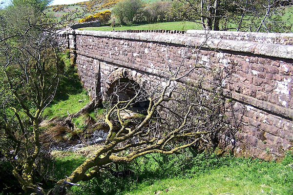 BMA08.jpg (taken 3.5.2006) |
||
|
|
||
| evidence:- | old map:- Bell 1892 placename:- Cross Dale Bridge |
|
| source data:- | Map, colour lithograph, Road Map of Cumberland, by George Joseph
Bell, scale about 2.5 miles to 1 inch, printed by Charles
Thurnam and Sons, Carlisle, Cumberland, 1892.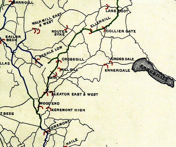 BEL9NY01.jpg "CROSS DALE" bridge symbol Road map of Cumberland showing County Bridges item:- Carlisle Library : Map 38 Image © Carlisle Library |
|
|
|
||
 Lakes Guides menu.