 Old Cumbria Gazetteer
 |
 |
|
| Fellbarrow, Loweswater | ||
| Fellbarrow | ||
| civil parish:- | Loweswater (formerly Cumberland) | |
| civil parish:- | Blindbothel (formerly Cumberland) | |
| county:- | Cumbria | |
| locality type:- | hill | |
| locality type:- | boundary feature | |
| locality type:- | parish boundary feature | |
| coordinates:- | NY13212425 | |
| 1Km square:- | NY1324 | |
| 10Km square:- | NY12 | |
| altitude:- | 1364 feet | |
| altitude:- | 416m | |
|
|
||
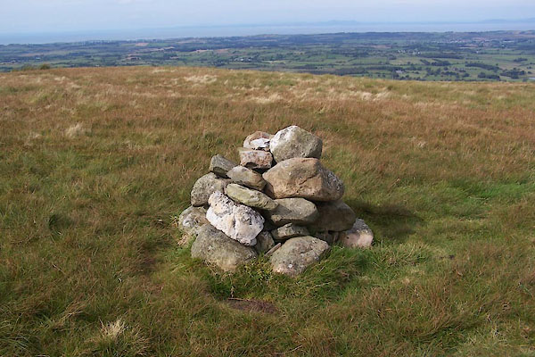 BXK16.jpg (taken 23.9.2012) |
||
| well; it's very neat little pile of stones. |
||
|
|
||
| evidence:- | old map:- OS County Series (Cmd 62 4) placename:- Fellbarrow |
|
| source data:- | Maps, County Series maps of Great Britain, scales 6 and 25
inches to 1 mile, published by the Ordnance Survey, Southampton,
Hampshire, from about 1863 to 1948. "Fellbarrow / Pile of Stones/ Md" and a trig point symbol |
|
|
|
||
| evidence:- | possibly old map:- Gents Mag 1751 placename:- Dick Knave |
|
| source data:- | Map, uncoloured engraving, Map of the Black Lead Mines in
Cumberland, and area, scale about 2 miles to 1 inch, by George
Smith, published in the Gentleman's Magazine, 1751. GM1303.jpg "Dick knave" knobbly hillocks; mountains item:- JandMN : 114 Image © see bottom of page |
|
|
|
||
 Lakes Guides menu.