Old Cumbria Gazetteer
 |
 |
|
||
| Greta, River | ||||
| runs into:- |  Derwent, River Derwent, River |
|||
|
|
||||
| civil parish:- | Keswick (formerly Cumberland) | |||
| civil parish:- | St John's Castlerigg and Wythburn (formerly Cumberland) | |||
| civil parish:- | Underskiddaw (formerly Cumberland) | |||
| civil parish:- | Threlkeld (formerly Cumberland) | |||
| county:- | Cumbria | |||
| locality type:- | river | |||
| locality type:- | boundary | |||
| locality type:- | parish boundary | |||
| 1Km square:- | NY2924 | |||
| 10Km square:- | NY22 | |||
|
|
||||
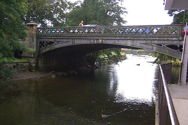
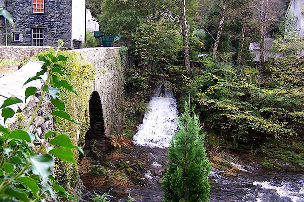
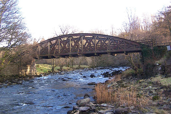
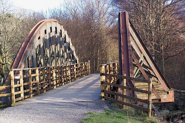
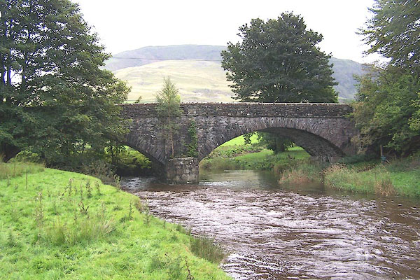
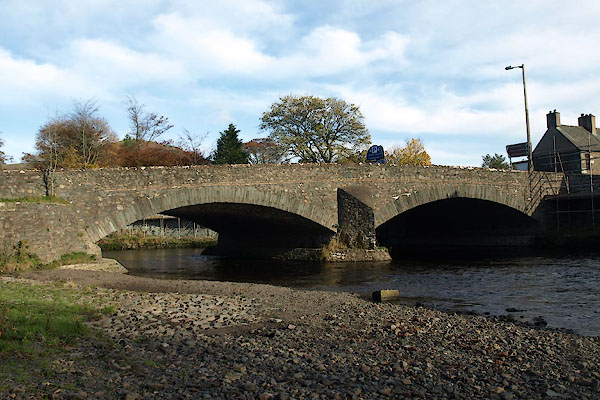
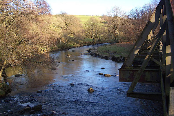 BNE75.jpg At the railway bridge. The join of the Glenderaterra and Glenderamackin rivers. (taken 17.2.2007) 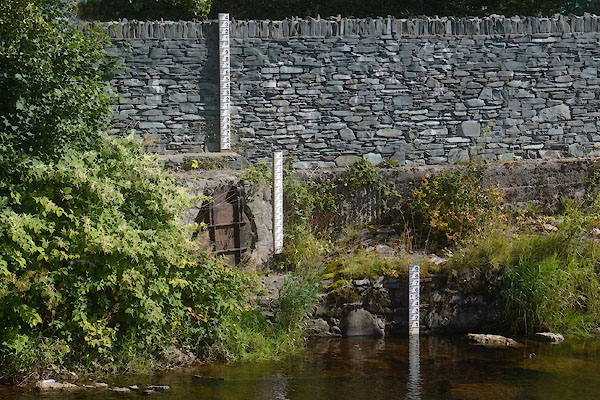 CDX76.jpg Depth gauges near Greta Bridge, (taken 16.9.2015) |
||||
|
|
||||
| evidence:- | old map:- OS County Series (Cmd 64 3) placename:- Greta, River |
|||
| source data:- | Maps, County Series maps of Great Britain, scales 6 and 25
inches to 1 mile, published by the Ordnance Survey, Southampton,
Hampshire, from about 1863 to 1948. OS County Series (Cmd 64 4) |
|||
|
|
||||
| evidence:- | old map:- Saxton 1579 |
|||
| source data:- | Map, hand coloured engraving, Westmorlandiae et Cumberlandiae Comitatus ie Westmorland
and Cumberland, scale about 5 miles to 1 inch, by Christopher Saxton, London, engraved
by Augustinus Ryther, 1576, published 1579-1645.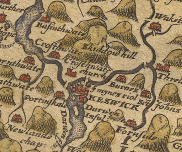 Sax9NY22.jpg item:- private collection : 2 Image © see bottom of page |
|||
|
|
||||
| evidence:- | old map:- Mercator 1595 (edn?) placename:- |
|||
| source data:- | Map, hand coloured engraving, Northumbria, Cumberlandia, et
Dunelmensis Episcopatus, ie Northumberland, Cumberland and
Durham etc, scale about 6.5 miles to 1 inch, by Gerard Mercator,
Duisberg, Germany, about 1595.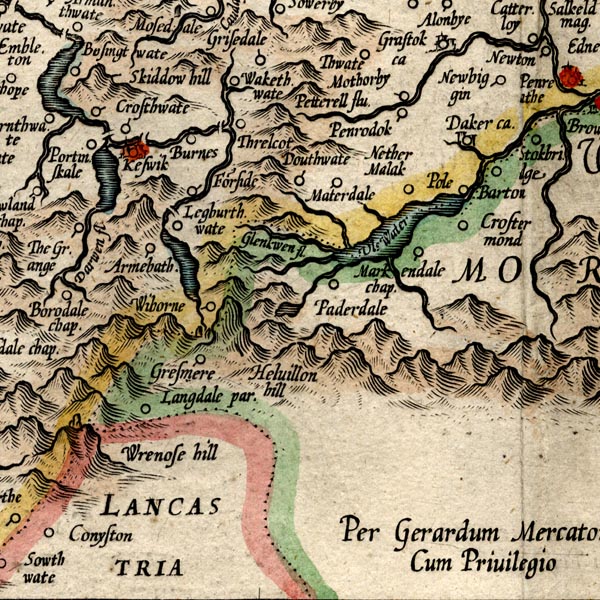 MER8CumF.jpg "" double line with stream lines; river, running into the Derwent item:- JandMN : 169 Image © see bottom of page |
|||
|
|
||||
| evidence:- | old map:- Speed 1611 (Cmd) |
|||
| source data:- | Map, hand coloured engraving, Cumberland and the Ancient Citie
Carlile Described, scale about 4 miles to 1 inch, by John Speed,
1610, published by J Sudbury and George Humble, Popes Head
Alley, London, 1611-12.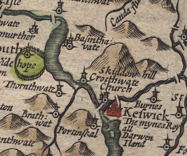 SP11NY22.jpg double line with stream lines, runs into the Derwent item:- private collection : 16 Image © see bottom of page |
|||
|
|
||||
| evidence:- | old map:- Jansson 1646 |
|||
| source data:- | Map, hand coloured engraving, Cumbria and Westmoria, ie
Cumberland and Westmorland, scale about 3.5 miles to 1 inch, by
John Jansson, Amsterdam, Netherlands, 1646.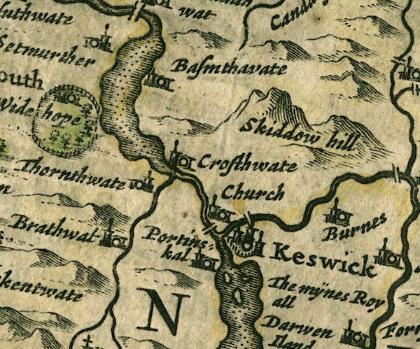 JAN3NY22.jpg Double wiggly line, tapering to single. item:- JandMN : 88 Image © see bottom of page |
|||
|
|
||||
| evidence:- | old map:- Ogilby 1675 (plate 96) placename:- Thurlmire Fluvius |
|||
| source data:- | Road strip map, hand coloured engraving, the Road from Kendal to
Cockermouth, and the Road from Egremond to Carlisle, scale about
1 inch to 1 mile, by John Ogilby, London, 1675.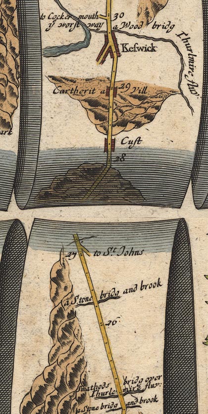 OG96m025.jpg In mile 29, Cumberland. "Thurlmire fluv:" alongside the right of the road then crossing under:- "a Wood bridg" no bridge drawn; tributary to the River Derwent. item:- JandMN : 22 Image © see bottom of page |
|||
|
|
||||
| evidence:- | old map:- Sanson 1679 |
|||
| source data:- | Map, hand coloured engraving, Ancien Royaume de Northumberland
aujourdhuy Provinces de Nort, ie the Ancient Kingdom of
Northumberland or the Northern Provinces, scale about 9.5 miles
to 1 inch, by Nicholas Sanson, Paris, France, 1679. click to enlarge click to enlargeSAN2Cm.jpg tapering wiggly line; river item:- Dove Cottage : 2007.38.15 Image © see bottom of page |
|||
|
|
||||
| evidence:- | old map:- Seller 1694 (Cmd) |
|||
| source data:- | Map, uncoloured engraving, Cumberland, scale about 12 miles to 1
inch, by John Seller, 1694. click to enlarge click to enlargeSEL9.jpg two lines cross a stream; bridge item:- Dove Cottage : 2007.38.89 Image © see bottom of page |
|||
|
|
||||
| evidence:- | old map:- Morden 1695 (Cmd) |
|||
| source data:- | Map, uncoloured engraving, Cumberland, scale about 4 miles to 1
inch, by Robert Morden, 1695, published by Abel Swale, the
Unicorn, St Paul's Churchyard, Awnsham, and John Churchill, the
Black Swan, Paternoster Row, London, 1695-1715.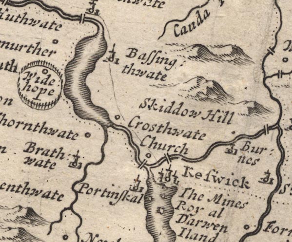 MD12NY22.jpg item:- JandMN : 90 Image © see bottom of page |
|||
|
|
||||
| evidence:- | old map:- Bowen 1720 (plate 260) placename:- Thurlemire Flu. |
|||
| source data:- | Road strip map, uncoloured engraving, pl.260, The Road from
Kendal to Cockermouth, scale about 2 miles to 1 inch, with
sections in Westmorland and Cumberland, published by Emanuel
Bowen, St Katherines, London, 1720.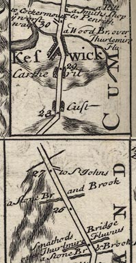 B260m25.jpg "a Wood Br. over Thurlemire Flu" On far side of Keswick. item:- private collection : 1.260 Image © see bottom of page |
|||
|
|
||||
| evidence:- | old map:- Gents Mag 1751 placename:- Greata River |
|||
| source data:- | Map, uncoloured engraving, Map of the Black Lead Mines in
Cumberland, and area, scale about 2 miles to 1 inch, by George
Smith, published in the Gentleman's Magazine, 1751.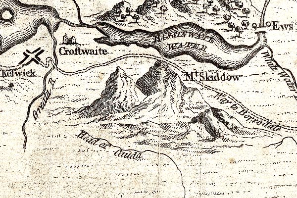 GM1314.jpg "Greata R." tapering wiggly line; river item:- JandMN : 114 Image © see bottom of page |
|||
|
|
||||
| evidence:- | old map:- Bowen and Kitchin 1760 |
|||
| source data:- | Map, hand coloured engraving, A New Map of the Counties of
Cumberland and Westmoreland Divided into their Respective Wards,
scale about 4 miles to 1 inch, by Emanuel Bowen and Thomas
Kitchin et al, published by T Bowles, Robert Sayer, and John
Bowles, London, 1760. BO18NY21.jpg wiggly line, into the Derwent item:- Armitt Library : 2008.14.10 Image © see bottom of page |
|||
|
|
||||
| evidence:- | old map:- Donald 1774 (Cmd) placename:- Greeta River |
|||
| source data:- | Map, hand coloured engraving, 3x2 sheets, The County of Cumberland, scale about 1
inch to 1 mile, by Thomas Donald, engraved and published by Joseph Hodskinson, 29
Arundel Street, Strand, London, 1774. D4NY22SE.jpg  D4NY32SW.jpg "Greeta R." single or double wiggly line; a river item:- Carlisle Library : Map 2 Images © Carlisle Library |
|||
|
|
||||
| evidence:- | descriptive text:- West 1778 (11th edn 1821) |
|||
| source data:- | Guide book, A Guide to the Lakes, by Thomas West, published by
William Pennington, Kendal, Cumbria once Westmorland, and in
London, 1778 to 1821. goto source Page 106:- "[from Latrigg] ... Below you, rolls the Greta, and, in its course, visits the town before it joins the Derwent, where it issues from the lake, and then their united streams are seen meandering through the vale till they meet the floods of Bassenthwaite, under the verdant skirts of Wythop brows." "..." goto sourcePage 108:- "..." "Return to the gate [from Latrigg], and enter the inclosure. Proceed, as soon as you can, to the right, having the wall at some distance, till you arrive at the brink of a green precipice; there you will be entertained with the noise of the rapid Greta (roaring through a craggy channel) that, in a run of two miles, exhibits an uncommon appearance, forming twelve or more of the finest bends and serpentine curves that ever fancy pencilled. The point for viewing this uncommon scene, is directly above the bridge, which hangs gracefully over the river." "..." goto sourcePage 110:- "... [from the front of Mr. Wren's house] A river is seen on both sides of the vale, lengthening its course in meanders, till it meets Threlkeld-water, or Glenderamackin-beck, at New-bridge, where it takes the name of Greeta. This picture is improved at the brow of the hill, on the western side of the house. Here the Greeta is seen from the bridge, running under the hill where you stand, and on the right, coming forth in a fine deep-channelled stream, between steep wooded banks." |
|||
|
|
||||
| evidence:- | old map:- Crosthwaite 1783-94 (Der) |
|||
| source data:- | Map, uncoloured engraving, An Accurate Map of the Matchless Lake
of Derwent, ie Derwent Water, scale about 3 inches to 1 mile, by
Peter Crosthwaite, Keswick, Cumberland, 1783, version published
1800. CT2NY22K.jpg  CT2NY22Q.jpg "Greata R." item:- Armitt Library : 1959.191.3 Image © see bottom of page |
|||
|
|
||||
| evidence:- | old map:- West 1784 map placename:- Greeta River |
|||
| source data:- | Map, hand coloured engraving, A Map of the Lakes in Cumberland,
Westmorland and Lancashire, scale about 3.5 miles to 1 inch,
engraved by Paas, 53 Holborn, London, about 1784. Ws02NY22.jpg item:- Armitt Library : A1221.1 Image © see bottom of page |
|||
|
|
||||
| evidence:- | old text:- Clarke 1787 placename:- Greeta, River item:- fish, River Greta; salmon; bass bruid |
|||
| source data:- | Guide book, A Survey of the Lakes of Cumberland, Westmorland,
and Lancashire, written and published by James Clarke, Penrith,
Cumberland, and in London etc, 1787; published 1787-93. goto source Page 62:- "... descend the hill; the road winds along the banks of the river Greeta, which contains the waters of Trout-Beck, Glendower-Meckine, Wanthwaite-Beck, Glendoweratera and Naddle-Beck. This river (which is here a very considerable stream) has its bottom covered with very large stones, under which fish of various kinds take shelter; here they are secure from nets, and afford excellent diversion to the angler. Salmon follow the course of this river as far as Flaskeu, so that it is well stocked with smelts, brandlings, and salmon-trouts. There are also taken in this river large quantities of what they call here Bass-bruid, from their resemblance to the perch, or bass; this fish is seldom more than three inches in length, and sometimes caught in the quantity of two or three pecks by one single person." "..." |
|||
|
|
||||
| evidence:- | old map:- Clarke 1787 map (Der) placename:- Greeta, River |
|||
| source data:- | Map, uncoloured engraving, Map of Derwentwater and its Environs,
scale about 13 ins to 1 mile, by James Clarke, engraved by S J
Neele, published by James Clarke, Penrith, Cumberland and in
London etc, 1787. CL152523.jpg running into the Derwent  CL152623.jpg "RIVER GREETA" river item:- private collection : 169 Image © see bottom of page |
|||
|
|
||||
| evidence:- | old map:- Clarke 1787 map (Penrith to Keswick) placename:- Creta, River |
|||
| source data:- | Map, A Map of the Roads, Waters &c between Penrith and Keswick, scale about 2 ins
to 1 mile, by James Clarke, engraved by S J Neele, 352 Strand, published by James
Clarke, Penrith, Cumberland and in London etc, 1787. click to enlarge click to enlargeCL05.jpg "RIVER CRETA" item:- private collection : 10.5 Image © see bottom of page |
|||
|
|
||||
| evidence:- | old print:- Farington 1789 |
|||
| source data:- | Print, uncoloured engraving, North Entrance to Keswick, Cumberland, drawn by Joseph
Farington, engraved by W Byrne and T Medland, published by William Byrne, 79 Titchfield
Street, London, 1787.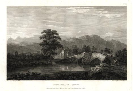 click to enlarge click to enlargeFA0309.jpg printed, top right "No.IX" printed, bottom left, right, centre "Drawn by Josh. Farington R.A. / Engraved by W. Byrne &T. Medland. / NORTH ENTRANCE to KESWICK. / Published as the Act directs, 2d. April 1787, by W. Byrne, No.79, Titchfield Street, London." item:- Armitt Library : A6668.9 Image © see bottom of page |
|||
|
|
||||
| evidence:- | old drawing:- Green 1809 (plate 68) placename:- Greta, River |
|||
| source data:- | Drawing, pencil, Keswick from beside the River Greta, by William Green, Ambleside,
Westmorland, about 1809.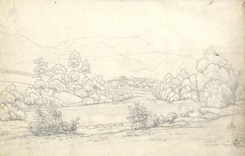 click to enlarge click to enlargePR1711.jpg item:- Armitt Library : 2000.189 Image © see bottom of page |
|||
|
|
||||
| evidence:- | old print:- Green 1809 placename:- Greta |
|||
| source data:- | Print, soft ground etching, Keswick from the Greta, Cumberland, by William Green,
published by William Green, Ambleside, Westmorland, and Longman, Hurst, Rees and Orme,
Paternoster Row, London, 1809.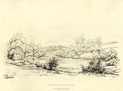 click to enlarge click to enlargeGN0368.jpg Plate 68 in Seventy Eight Studies from Nature. printed in introductory pages to set of prints:- "Number 68. The source of the Greta is Leathes Water, from which it runs through St. John's vale, by Threlkeld to Keswick, and joins the Derwent at Portinscale. The view of Keswick here given, is from the road to Penrith, near the Turnpike-gate; ..." printed at bottom:- "KESWICK FROM THE GRETA. / Published Ambleside, Augst. 1st. 1809, by W. Green." item:- Armitt Library : A6637.68 Image © see bottom of page |
|||
|
|
||||
| evidence:- | old print:- Green 1809 placename:- Greta, River item:- weir (?) |
|||
| source data:- | Print, soft ground etching, The River Greta near Keswick, Cumberland, by William Green,
published by William Green, Ambleside, Westmorland, and Longman, Hurst, Rees and Orme,
Paternoster Row, London, 1809.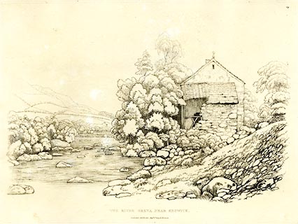 click to enlarge click to enlargeGN0369.jpg Plate 69 in Seventy Eight Studies from Nature. printed in introductory pages to set of prints:- "Number 69. The Weir, which causes a supply of water for the town's Corn Mill, may be observed in this and the preceeding print; and as this view is up the river, the station to take it from will consequently be nearer Keswick than that for the former one: the Mill is beyond the building in ruins." printed at bottom:- "THE RIVER GRETA NEAR KESWICK. / Published Ambleside, Augst. 1st. 1809, by W. Green." item:- Armitt Library : A6637.69 Image © see bottom of page |
|||
|
|
||||
| evidence:- | road book:- Cary 1798 (2nd edn 1802) placename:- Greta, River |
|||
| source data:- | Road book, itineraries, Cary's New Itinerary, by John Cary, 181
Strand, London, 2nd edn 1802. goto source click to enlarge click to enlargeC38317.jpg page 317-318 "Cross the Greta River." twice item:- JandMN : 228.1 Image © see bottom of page |
|||
|
|
||||
| evidence:- | road book:- Cary 1798 (2nd edn 1802) placename:- Greta, River |
|||
| source data:- | Road book, itineraries, Cary's New Itinerary, by John Cary, 181
Strand, London, 2nd edn 1802. goto source click to enlarge click to enlargeC38733.jpg page 733-734 "Cross the Greta River" item:- JandMN : 228.2 Image © see bottom of page |
|||
|
|
||||
| evidence:- | old map:- Laurie and Whittle 1806 placename:- Greata River |
|||
| source data:- | Road map, Completion of the Roads to the Lakes, scale about 10
miles to 1 inch, by Nathaniel Coltman? 1806, published by Robert
H Laurie, 53 Fleet Street, London, 1834. click to enlarge click to enlargeLw18.jpg "Greata R." river item:- private collection : 18.18 Image © see bottom of page |
|||
|
|
||||
| evidence:- | old map:- Cooper 1808 |
|||
| source data:- | Map, uncoloured engraving, Cumberland, scale about 10.5 miles to
1 inch, drawn and engraved by Cooper, published by R Phillips,
Bridge Street, Blackfriars, London, 1808. click to enlarge click to enlargeCOP3.jpg tapering wiggly line; river item:- JandMN : 86 Image © see bottom of page |
|||
|
|
||||
| evidence:- | old print with text:- Farington 1816 placename:- Greta, River |
|||
| source data:- | Print, uncoloured engraving and descriptive text, Saddleback and the River Rothay,
corrected to the River Greta by the text, Cumberland, drawn by Joseph Farington, engraved
by W Woolnoth, published by T Cadell and W Davies, Strand, London, 1815.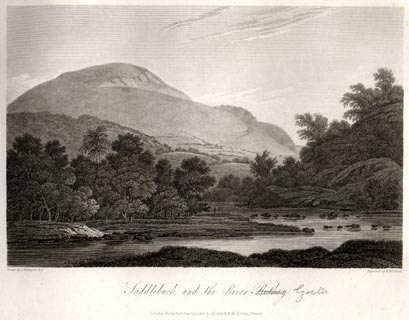 click to enlarge click to enlargeFA0405.jpg printed, bottom left, right, centre "Drawn by J. Farington R.A. / Engraved by W. Woolnoth. / Saddleback and the River Rothay. / London Published Septr. 15, 1815, by T. Cadell &W. Davies, Strand." Descriptive text:- "SADDLEBACK AND THE RIVER GRETA." "... this mountain, at whose foot flows the little river Greta, which adds much to the picturesque effect of the scenery. ..." item:- Armitt Library : A6666.5 Image © see bottom of page |
|||
|
|
||||
| evidence:- | old map:- Otley 1818 placename:- Greta River |
|||
| source data:- | Map, uncoloured engraving, The District of the Lakes,
Cumberland, Westmorland, and Lancashire, scale about 4 miles to
1 inch, by Jonathan Otley, 1818, engraved by J and G Menzies,
Edinburgh, Scotland, published by Jonathan Otley, Keswick,
Cumberland, et al, 1833.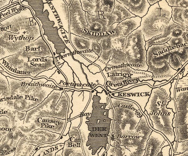 OT02NY22.jpg item:- JandMN : 48.1 Image © see bottom of page |
|||
|
|
||||
| evidence:- | descriptive text:- Otley 1823 (5th edn 1834) |
|||
| source data:- | Guide book, A Concise Description of the English Lakes, the
mountains in their vicinity, and the roads by which they may be
visited, with remarks on the mineralogy and geology of the
district, by Jonathan Otley, published by the author, Keswick,
Cumberland now Cumbria, by J Richardson, London, and by Arthur
Foster, Kirkby Lonsdale, Cumbria, 1823; published 1823-49,
latterly as the Descriptive Guide to the English Lakes. goto source Page 40:- "..." "The river issuing from Thirlmere, commonly called St. John's beck, ... the one from Mungrisdale by Threlkeld Glenderamakin; after their junction it takes the name of Greta, and receives the Glenderaterra from between Skiddaw and Saddleback; passing Keswick, it joins the Derwent, shortly after that river leaves the lake. In heavy rains the Greta sometimes rises so suddenly that it inverts the stream of the Derwent, so that the lake is for a short time literally filled from all quarters. ..." "..." goto sourcePage 149:- "That rock of granite which seems best entitled to the distinction of primitive, may be seen denudated in the bed of the river Caldew, near the north-east side of Skiddaw; and in a branch of the river Greta, between Skiddaw and Saddleback, about 1400 feet above the level of the sea. This granite is of a grey kind, composed of quartz, white felspar, and black mica. It is traversed in various directions by veins of quartz; in some of which, molybdena, apatite, tungsten, wolfram, and other minerals have been found." |
|||
|
|
||||
| evidence:- | descriptive text:- Ford 1839 (3rd edn 1843) placename:- Greta |
|||
| source data:- | Guide book, A Description of Scenery in the Lake District, by
Rev William Ford, published by Charles Thurnam, Carlisle, by W
Edwards, 12 Ave Maria Lane, Charles Tilt, Fleet Street, William
Smith, 113 Fleet Street, London, by Currie and Bowman,
Newcastle, by Bancks and Co, Manchester, by Oliver and Boyd,
Edinburgh, and by Sinclair, Dumfries, 1839. goto source Page 59:- "..." "THE GRETA." "There is not a more interesting walk than up this river, which presents splendid views of Blencathra as you follow the stream up its course. Downwards there is an attractive picture, the cotton-mill being in front, whilst over a bend of the stream, flanked by woods, are seen the distant mountains of Newlands." |
|||
|
|
||||
| evidence:- | old map:- Ford 1839 map placename:- Greta River |
|||
| source data:- | Map, uncoloured engraving, Map of the Lake District of
Cumberland, Westmoreland and Lancashire, scale about 3.5 miles
to 1 inch, published by Charles Thurnam, Carlisle, and by R
Groombridge, 5 Paternoster Row, London, 3rd edn 1843.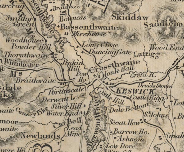 FD02NY22.jpg "Greta R." item:- JandMN : 100.1 Image © see bottom of page |
|||
|
|
||||
| evidence:- | old map:- Garnett 1850s-60s H placename:- Greta, River |
|||
| source data:- | Map of the English Lakes, in Cumberland, Westmorland and
Lancashire, scale about 3.5 miles to 1 inch, published by John
Garnett, Windermere, Westmorland, 1850s-60s. GAR2NY32.jpg "Greta R." wiggly line, river item:- JandMN : 82.1 Image © see bottom of page |
|||
|
|
||||
| evidence:- | old map:- Postlethwaite 1877 (3rd edn 1913) placename:- Greta, River |
|||
| source data:- | Map, uncoloured engraving, Map of the Lake District Mining Field, Westmorland, Cumberland,
Lancashire, scale about 5 miles to 1 inch, by John Postlethwaite, published by W H
Moss and Sons, 13 Lowther Street, Whitehaven, Cumberland, 1877 edn 1913. PST2NY22.jpg "R. Greta" wiggly line item:- JandMN : 162.2 Image © see bottom of page |
|||
|
|
||||
| evidence:- | old drawing:- Green 1809 (plate 68) placename:- Greta, River |
|||
| source data:- | Drawing, pencil, Keswick from beside the River Greta, by William Green, Ambleside,
Westmorland, about 1809. click to enlarge PR1711.jpg item:- Armitt Library : 2000.189 Image © see bottom of page |
|||
|
|
||||
| evidence:- | old print:- Green 1809 placename:- Greta |
|||
| source data:- | Print, soft ground etching, Keswick from the Greta, Cumberland, by William Green,
published by William Green, Ambleside, Westmorland, and Longman, Hurst, Rees and Orme,
Paternoster Row, London, 1809. click to enlarge GN0368.jpg Plate 68 in Seventy Eight Studies from Nature. printed in introductory pages to set of prints:- "Number 68. The source of the Greta is Leathes Water, from which it runs through St. John's vale, by Threlkeld to Keswick, and joins the Derwent at Portinscale. The view of Keswick here given, is from the road to Penrith, near the Turnpike-gate; ..." printed at bottom:- "KESWICK FROM THE GRETA. / Published Ambleside, Augst. 1st. 1809, by W. Green." item:- Armitt Library : A6637.68 Image © see bottom of page |
|||
|
|
||||
| evidence:- | old print:- Green 1809 placename:- Greta, River item:- weir (?) |
|||
| source data:- | Print, soft ground etching, The River Greta near Keswick, Cumberland, by William Green,
published by William Green, Ambleside, Westmorland, and Longman, Hurst, Rees and Orme,
Paternoster Row, London, 1809. click to enlarge GN0369.jpg Plate 69 in Seventy Eight Studies from Nature. printed in introductory pages to set of prints:- "Number 69. The Weir, which causes a supply of water for the town's Corn Mill, may be observed in this and the preceeding print; and as this view is up the river, the station to take it from will consequently be nearer Keswick than that for the former one: the Mill is beyond the building in ruins." printed at bottom:- "THE RIVER GRETA NEAR KESWICK. / Published Ambleside, Augst. 1st. 1809, by W. Green." item:- Armitt Library : A6637.69 Image © see bottom of page |
|||
|
|
||||
| evidence:- | old print:- Goodwin 1887 (edn 1890) placename:- Greta, The |
|||
| source data:- | Print, etching? The River Greta, Keswick, Cumberland, by Harry Goodwin, published
by Swan Sonnenschein and Co, Paternoster Square, London, 1890.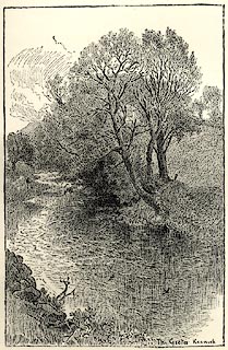 click to enlarge click to enlargePR1618.jpg Tipped in opposite p.228 of Through the Wordsworth Country, by William Knight. printed at lower right:- "The Greta Keswick" item:- JandMN : 382.48 Image © see bottom of page |
|||
|
|
||||
| evidence:- | old print:- Pyne 1853 placename:- Greta, River |
|||
| source data:- | Drawn by James Barker Pyne, 1848-1853, lithographed by T Picken, 1859.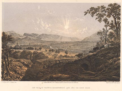 click to enlarge click to enlargePY24.jpg "Vale of Keswick, Bassenthwaite Lake and the River Greta" item:- JandMN : 97.21 Image © see bottom of page |
|||
|
|
||||
| evidence:- | old print:- placename:- Greta item:- road |
|||
| source data:- | Print, uncoloured engraving, Bridge over the Greta, Keswick, Cumberland, by ?B Foster,
engraved by E Evans, 1850s-60s?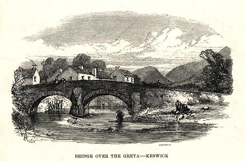 click to enlarge click to enlargePR0494.jpg printed at bottom left, right, centre:- "[B] Foster / E. EVANS SC. / BRIDGE OVER THE GRETA - KESWICK" item:- Dove Cottage : 2008.107.443 Image © see bottom of page |
|||
|
|
||||
| evidence:- | old print:- Rose 1832-35 (vol.1 no.44) |
|||
| source data:- | Print, uncoloured engraving, Keswick, from Greta Bridge, Cumberland, drawn by H Gastineau,
engraved by W le Petit, published by Fisher, Son and Co, London, 1833.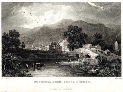 click to enlarge click to enlargePR0018.jpg vol.1 pl.44 in the set of prints, Westmorland, Cumberland, Durham and Northumberland Illustrated. printed at bottom left, right, centre:- "H. Gastineau. / W Le Petit. / KESWICK, FROM GRETA BRIDGE. / FISHER, SON &CO. LONDON, 1833." item:- Dove Cottage : 2008.107.18 Image © see bottom of page |
|||
|
|
||||
| evidence:- | old print:- |
|||
| source data:- | Print, uncoloured engraving, Greta Hall and Keswick Bridge, Cumberland, drawn by W
Westall, engraved by E Francis, about 1830s?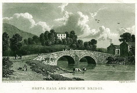 click to enlarge click to enlargePR0151.jpg printed at bottom left, right, centre:- "Drawn by W. Westall, A.R.A. / Engraved by E. Francis. / GRETA HALL AND KESWICK BRIDGE." item:- Dove Cottage : 2008.107.151 Image © see bottom of page |
|||
|
|
||||
| evidence:- | old print with text:- Farington 1816 (plate 33) |
|||
| source data:- | Print, uncoloured engraving, Saddleback and the River Rothay (the Greta), drawn by
Joseph Farington, engraved by W Woolnoth, published by T Cadell and W Davies, Strand,
London, 1815.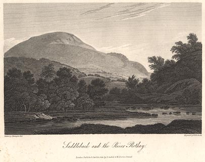 click to enlarge click to enlargeBNV36.jpg printed at bottom:- "... Saddleback and the River Rothay. ..." Plate 33 in The Lakes of Lancashire, Westmorland and Cumberland ... with text by Thomas Hartwell Horne:- "SADDLEBACK AND THE RIVER GRETA. / ... this mountain, at whose foot flows the little river Greta, which adds much to the picturesque effect of the scenery. ..." item:- private collection : 77 Image © see bottom of page |
|||
|
|
||||
| hearsay:- |
Peter Crosthwaite's diary 10 June 1785 notes:- |
|||
| "Soon this morning found six musical stones at the end of Long Tongue" |
||||
| in the bed of the River Greta; the stones were perfectly in tune. After another six
months of finds, and some chipping away to put things in tune, he had two octaves
for a lithophone. |
||||
| : 1877=1878; Transactions of the Cumberland Association for the Advancement of Literature:
part 3: p.155 |
||||
|
|
||||
| notes:- |
Robert Southey commented on its meanderings:- |
|||
| "Ambiguo lapsu refluitque fluitque Occurrensque sibi venturas aspicit undas" |
||||
| or, perhaps:- |
||||
| "The devious streamlet flows, reflows, and flowing Doth gaze on whence it coms and whither going" |
||||
| Baron 1925 |
||||
|
|
||||
| places:- |
|
|||
|
||||
|
||||
|
||||
|
||||
|
||||
|
||||
|
||||
|
||||
|
||||
|
||||
|
||||
|
||||
|
||||
|
||||
|
||||
|
||||
|
||||
|
||||
|
||||
Lakes Guides menu.