 |
 |
|
|
|
|
Hazelslack |
| civil parish:- |
Beetham (formerly Westmorland) |
| county:- |
Cumbria |
| locality type:- |
locality |
| locality type:- |
buildings |
| coordinates:- |
SD47647877 (etc) |
| 1Km square:- |
SD4778 |
| 10Km square:- |
SD47 |
|
|
| evidence:- |
old map:- OS County Series (Wmd 46 6)
placename:- Hazelslack
|
| source data:- |
Maps, County Series maps of Great Britain, scales 6 and 25
inches to 1 mile, published by the Ordnance Survey, Southampton,
Hampshire, from about 1863 to 1948.
|
|
|
| evidence:- |
hearth tax returns:- Hearth Tax 1675
placename:- Heslacke
|
| source data:- |
Records, hearth tax survey returns, Westmorland, 1674/75.
"Heslacke"
in "Bethome"
|
|
|
| places:- |
 |
SD4679 Hazelslack Moss (Beetham) |
|
|
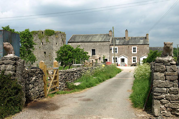 |
SD47657875 Hazelslack Tower Farm (Beetham) |
|
|
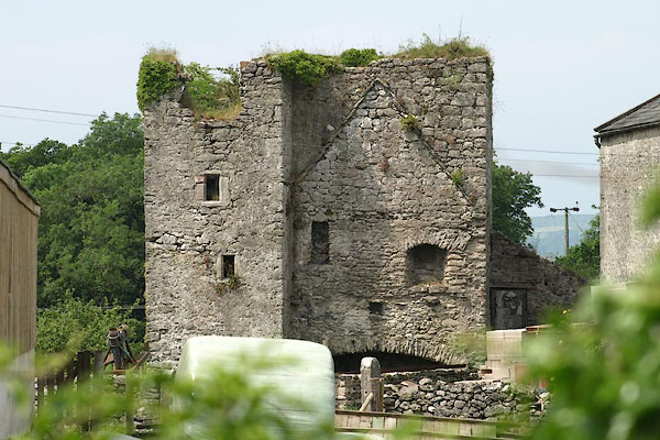 |
SD47627881 Hazelslack Tower (Beetham) L |
|
|
|
SD47637876 limekiln, Beetham (2) (Beetham) |
|
