 Old Cumbria Gazetteer
 |
 |
|
| High House, Longsleddale | ||
| High House | ||
| locality:- | Longsleddale | |
| civil parish:- | Longsleddale (formerly Westmorland) | |
| county:- | Cumbria | |
| locality type:- | buildings | |
| coordinates:- | NY50720186 | |
| 1Km square:- | NY5001 | |
| 10Km square:- | NY50 | |
|
|
||
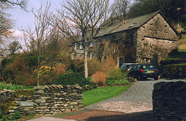 BIO17.jpg (taken 30.3.2004) 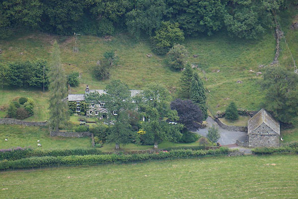 CBC34.jpg (taken 11.7.2014) |
||
|
|
||
| evidence:- | old map:- OS County Series (Wmd 27 16) placename:- High House |
|
| source data:- | Maps, County Series maps of Great Britain, scales 6 and 25
inches to 1 mile, published by the Ordnance Survey, Southampton,
Hampshire, from about 1863 to 1948.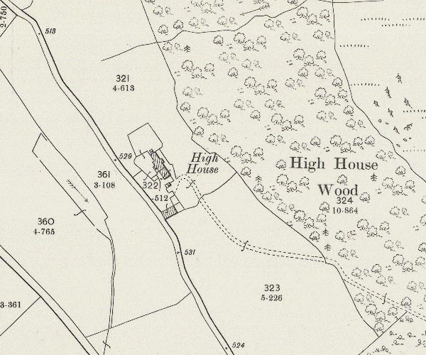 C5E019.jpg "High House" |
|
|
|
||
| evidence:- | census returns:- placename:- High House |
|
|
|
||
 old parish registers (formerly ) old parish registers (formerly ) |
||
|
|
||
| evidence:- | old map:- Jefferys 1770 (Wmd) placename:- High House placename:- House, High |
|
| source data:- | Map, 4 sheets, The County of Westmoreland, scale 1 inch to 1
mile, surveyed 1768, and engraved and published by Thomas
Jefferys, London, 1770.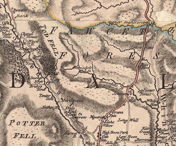 J5NY50SW.jpg "High H." circle, labelled in italic lowercase text; settlement, farm, house, or hamlet? item:- National Library of Scotland : EME.s.47 Image © National Library of Scotland |
|
|
|
||
| evidence:- | old map:- Hodgson 1828 placename:- High House |
|
| source data:- | Map, hand coloured engraving, 4 sheets mounted together on linen and rolled, Plan
of the County of Westmorland, scale about 1.25 inches to 1 mile, by Thomas Hodgson,
engraved by W R Gardner, Harpur Street, London, published by Thomas Hodgson, Lancaster,
and perhaps by C Smith, 172 Strand, London,1828.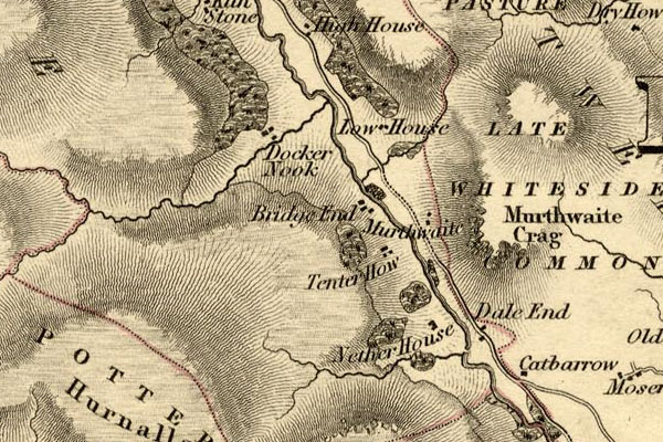 HDG6lsl1.jpg map courtesy of Mark Cropper "High House" item:- private collection : 371 Image © see bottom of page |
|
|
|
||
| Kendal Corn Rent Act 1836 |
||
|
|
||
| evidence:- | old map:- OS 1881-82 New Series (outline edition) placename:- High House |
|
| source data:- | Map, engraving, area north of Kendal, Westmorland, New Series
one inch map, outline edition, sheet 39, scale 1 inch to 1 mile,
published by the Ordnance Survey, Southampton, Hampshire,
1881-82.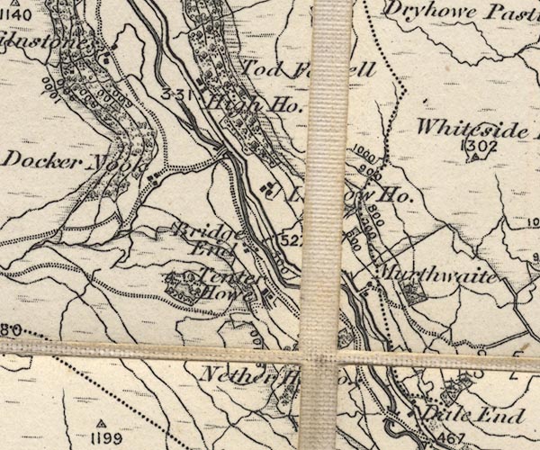 O21NY50A.jpg "High Ho." item:- JandMN : 61 Image © see bottom of page |
|
|
|
||
| census records |
||
|
|
||
| directory entries |
||
|
|
||
| evidence:- | database:- Listed Buildings 2010 |
|
| source data:- | courtesy of English Heritage "HIGH HOUSE CRUCK BARN / / / LONGSLEDDALE / SOUTH LAKELAND / CUMBRIA / II / 435489 / NY5072701816" |
|
|
|
||
| evidence:- | map:- OS Six Inch (1956) placename:- High House |
|
| source data:- | Map series, various editions with the national grid, scale about
6 inches to 1 mile, published by the Ordnance Survey,
Southampton, Hampshire, scale 1 to 10560 from 1950s to 1960s,
then 1 to 10000 from 1960s to 2000s, superseded by print on
demand from digital data.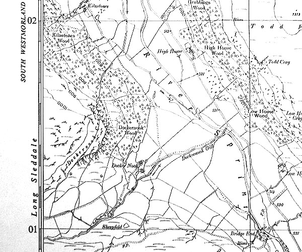 SINY5001.jpg "High House" |
|
|
|
||
| evidence:- | shepherds guide:- Hodgson 1849 placename:- High House |
|
| source data:- | Book, Shepherd's Guide, or a Delineation of the Wool and Ear
Marks of the Different Stocks of Sheep, Lancashire, Cumberland,
and Westmorland, by William Hodgson, Normoss, Corney,
Cumberland, 1849.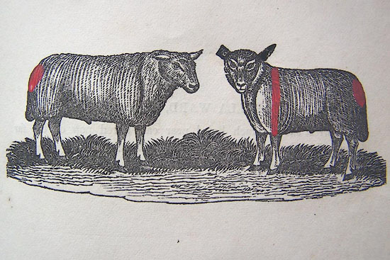 HG2p599a.jpg "MYLES SINKINSON, High House." "Cropper far ear. a red stroke down the near shoulder, and a pop at the tail head, RS on both horns." 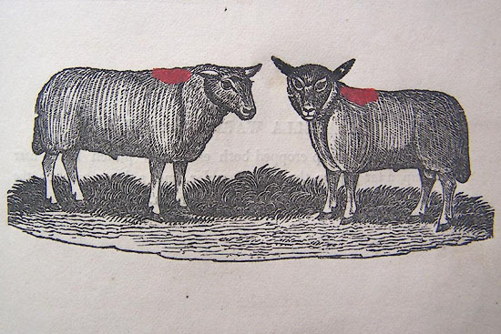 HG2p599b.jpg "MYLES SINKINSON." "Potter fell sheep no ear mark, a red pop on the top of the shoulders." item:- Kendal Library : 39 Image © see bottom of page |
|
|
|
||
 Lakes Guides menu.