 Old Cumbria Gazetteer
 |
 |
|
| Holme Islands, Crummock Water | ||
| Holme Islands | ||
| site name:- | Crummock Water | |
| civil parish:- | Buttermere (formerly Cumberland) | |
| county:- | Cumbria | |
| locality type:- | island | |
| coordinates:- | NY164171 | |
| 1Km square:- | NY1617 | |
| 10Km square:- | NY11 | |
|
|
||
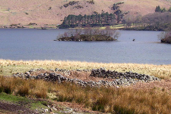 BPA46.jpg (taken 16.4.2008) |
||
|
|
||
| evidence:- | old map:- Crosthwaite 1783-94 (But/Cru/Low) |
|
| source data:- | Map, uncoloured engraving, An Accurate Map of Buttermere,
Crummock and Loweswater Lakes, scale about 3 inches to 1 mile,
by Peter Crosthwaite, Keswick, Cumberland, 1794, version
published 1800.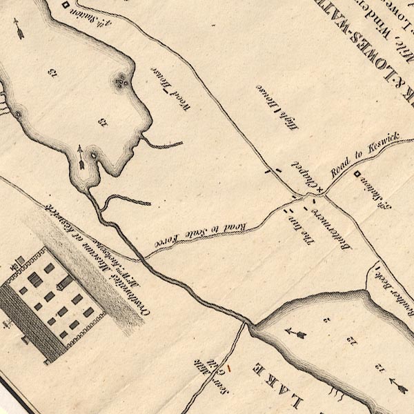 CT8NY11T.jpg Only 1 island is shown, but a headland is shown as well. item:- Armitt Library : 1959.191.2 Image © see bottom of page |
|
|
|
||
 Lakes Guides menu.